
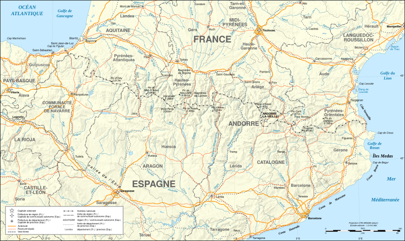
Archivo: Pyrenees map shaded relief-fr

Description: Map in French of the Pyrenees mountains with shaded relief. Note: The shaded relief is a raster image embedded in the SVG file.
Title: Pyrenees map shaded relief-fr
Credit: Own work ; Background map and shaded relief : NASA Shuttle Radar Topography Mission (SRTM3 v.2) (public domain); Rivers, borders, cities, roads and rail tracks : Demis add-on for World Wind (see the approval e-mail and the Demis forum); Other references used : NASA World Wind ; ViaMichelin.
Author: Eric Gaba (Sting - fr:Sting)
Permission: Attribution and Share-Alike required Any use of this map can be made as long as you credit me (Eric Gaba – Wikimedia Commons user: Sting) as the author and distribute the copies and derivative works under the same license(s) that the one(s) stated below. A message with a reply address would also be greatly appreciated.
Usage Terms: Creative Commons Attribution-Share Alike 3.0
License: CC-BY-SA-3.0
License Link: http://creativecommons.org/licenses/by-sa/3.0/
Attribution Required?: Yes
Usos del archivo
La siguiente página enlaza a este archivo:
