
Archivo: Prairie du Chien from Wyalusing State Park (telephoto)
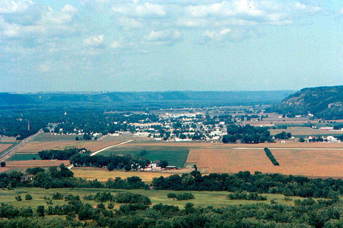
Descripción: A telephoto view of Prairie du Chien, Wisconsin, looking north from a viewpoint at Wyalusing State Park. The Mississippi River is in the background, but cannot be seen. The distant hills are in Iowa. The bluff above the river is at the far right, The Burlington Route railroad tracks (now Burlington Northern Santa Fe) run straight at the far left. The main part of Prairie du Chien is to the west (left) of the railroad. I believe that the field in the right foreground is part of the Prairie du Chien airport. U.S. Highway 18 ("the Great River Road) is beyond the airport. The center of the city is about 5 miles (8 km) from the viewpoint. The white triangle in the trees may be the spire of the disused Lutheran church across the street from my Aunt Marguerite's House. This photo is geotagged with the approximate camera location.
Título: Prairie du Chien from Wyalusing State Park (telephoto)
Créditos: Prairie du Chien from Wyalusing State Park (telephoto) Uploaded by Gary Dee
Autor(a): Roger Wollstadt from Sarasota, Florida
Términos de Uso: Creative Commons Attribution-Share Alike 2.0
Licencia: CC BY-SA 2.0
Enlace de Licencia: https://creativecommons.org/licenses/by-sa/2.0
¿Se exige la atribución?: Sí
Usos del archivo
La siguiente página enlaza a este archivo:
.jpg&oldid=3153106)

.jpg)