
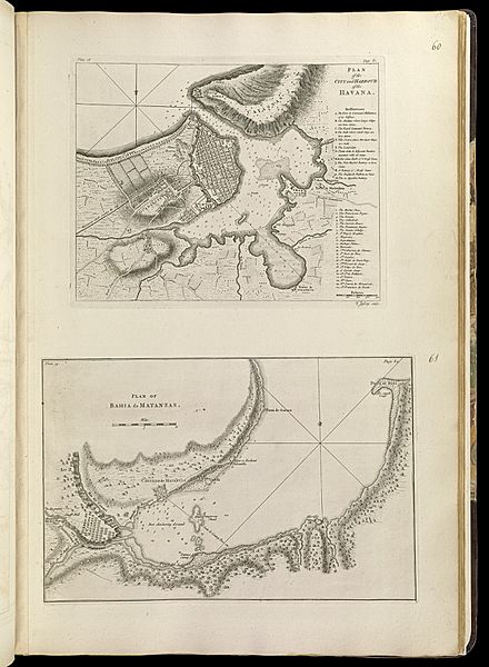
Archivo: Plan of the city and harbour of the Havana ; Plan of Bahia de Matanzas (18348737415)
Descripción: Zoom into this map at maps.bpl.org. Author: Jefferys, Thomas Publisher: Jefferys, Thomas, Sayer, Robert Date: 1768 Location: Havana (Cuba), Matanzas Bay (Cuba) Dimensions: 21 x 17 cm. and 21 x 32 cm., on sheet 56 x 37 cm. Scale: [ca. 1:21,000] and [ca. 1:295,000] Reference: LC Maps of North America, 1750-1789, 1809, 1826 Reference: Phillips, 1196 Call Number: G1105 .J4 1768
Título: Plan of the city and harbour of the Havana ; Plan of Bahia de Matanzas (18348737415)
Créditos: Plan of the city and harbour of the Havana ; Plan of Bahia de Matanzas
Autor(a): Norman B. Leventhal Map Center
Términos de Uso: Creative Commons Attribution 2.0
Licencia: CC BY 2.0
Enlace de Licencia: https://creativecommons.org/licenses/by/2.0
¿Se exige la atribución?: Sí
Usos del archivo
La siguiente página enlaza a este archivo:
.jpg&oldid=3565273)

.jpg)