
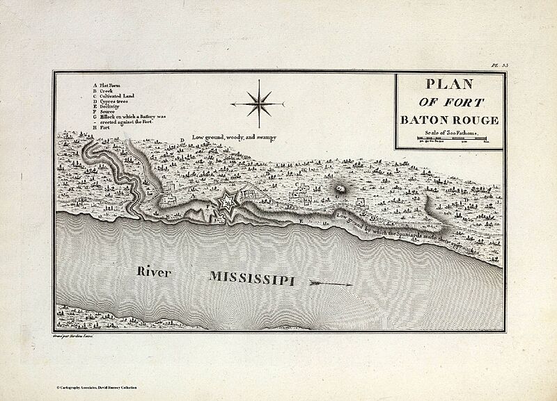
Archivo: Plan Of Fort Baton Rouge. Collot, George Henri Victor ; Tardieu, P.F. 1796
Descripción: Published In: A Journey in North America, containing a Survey of the Countries watered by the Mississippi, Ohio, Missouri, and other Affluing Rivers; with Exact Observations on the Course and Soundings of these Rivers; and on the Towns, Villages, Hamlets, and Farms of that Part of the New World; followed by Philosophical, Political, Military and Commercial Remarks, and by a Projected Line of Frontiers and General Limits. Illustrated by an Atlas of 36 Maps, etc. By Gen. V. Callot, late in the French Service, and Governor of Guadeloupe. Publication Author: Collot, George Henri Victor ; Tardieu, P.F. Publication Date: 1796
Título: Plan Of Fort Baton Rouge. Collot, George Henri Victor ; Tardieu, P.F. 1796
Créditos: David Rumsey Historical Map Collection http://www.davidrumsey.com/maps5575.html
Autor(a): Collot, George Henri Victor Tardieu, P.F.
Términos de Uso: Creative Commons Attribution-Share Alike 4.0
Licencia: CC BY-SA 4.0
Enlace de Licencia: https://creativecommons.org/licenses/by-sa/4.0
¿Se exige la atribución?: Sí
Usos del archivo
La siguiente página enlaza a este archivo:
