
Archivo: Pinus ponderosa subspecies range map
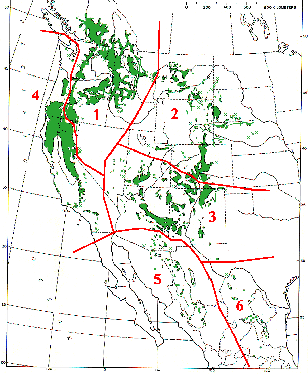
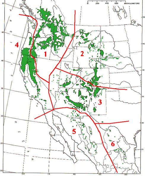
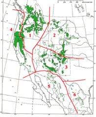
Descripción: Range map of Pinus ponderosa and Pinus arizonica Pinus ponderosa subsp. ponderosa - North Plateau Ponderosa Pine Pinus ponderosa subsp. scopulorum - Rocky Mts Ponderosa Pine Pinus ponderosa subsp. brachyptera - Southwestern Ponderosa Pine Pinus ponderosa subsp. benthamiana - Pacific Ponderosa Pine Pinus arizonica var. arizonica - Arizona Pine Pinus arizonica var. stormiae - Storm's Pine
Título: Pinus ponderosa subspecies range map
Créditos: Base map (black outlines & green range map) is from USDA Forest Service Misc,.Publ. 991 (public domain-USGov); red delineation is my work, which I release into public domain
Autor(a): MPF
Permiso: Public domainPublic domainfalsefalse This image is a work of the Forest Service of the United States Department of Agriculture. As a work of the U.S. federal government, the image is in the public domain.
Términos de Uso: Dominio Público
Licencia: Dominio Público
¿Se exige la atribución?: No
Usos del archivo
La siguiente página enlaza a este archivo:
