
Archivo: Pendoreillerivermap
Tamaño de esta previsualización: 609 × 600 píxeles. Otras resoluciones: 244 × 240 píxeles | 909 × 895 píxeles.
Archivo original (909 × 895 píxeles; tamaño de archivo: 1,01 MB; tipo MIME: image/jpeg)
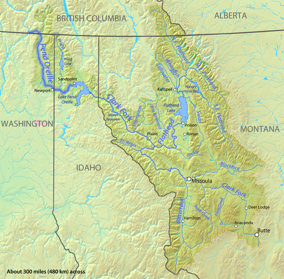
Descripción: Watershed map of the Pend Oreille River — a tributary of the Columbia River in Idaho, Washington, and British Columbia. Within the Columbia River Basin of the Northwestern United States and Western Canada. Showing the primary tributaries of the Pend Oreille River: the Clark Fork River) (Montana/Idaho) and its tributary the Bitterroot River; and the Flathead River (Montana).
Título: Pendoreillerivermap
Créditos: Drawn by myself; shaded relief from DEMIS Mapserver
Autor(a): Shannon1
Términos de Uso: Creative Commons Attribution-Share Alike 4.0
Licencia: CC BY-SA 4.0
Enlace de Licencia: https://creativecommons.org/licenses/by-sa/4.0
¿Se exige la atribución?: Sí
Usos del archivo
La siguiente página enlaza a este archivo:

Todo el contenido de los artículos de la Enciclopedia Kiddle (incluidas las imágenes) se puede utilizar libremente para fines personales y educativos bajo la licencia Atribución-CompartirIgual a menos que se indique lo contrario.