
Archivo: Pend Oreille River Map
Tamaño de esta previsualización: 741 × 599 píxeles. Otras resoluciones: 297 × 240 píxeles | 899 × 727 píxeles.
Archivo original (899 × 727 píxeles; tamaño de archivo: 123 KB; tipo MIME: image/png)
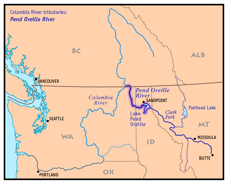
Description: A map of the Pend Oreille River — a tributary of the Columbia River in Idaho and Washington, within the Columbia River Basin of the Northwestern United States and Western Canada. Showing a primary tributary of the Pend Oreille, the Clark Fork River). Credits I, Pfly, created it based on USGS and Digital Chart of the World data.
Title: Pend Oreille River Map
Credit: Own work
Author: Pfly
Usage Terms: Creative Commons Attribution-Share Alike 3.0
License: CC-BY-SA-3.0
License Link: http://creativecommons.org/licenses/by-sa/3.0/
Attribution Required?: Yes
Usos del archivo
Las siguientes páginas enlazan a este archivo:

Todo el contenido de los artículos de la Enciclopedia Kiddle (incluidas las imágenes) se puede utilizar libremente para fines personales y educativos bajo la licencia Atribución-CompartirIgual a menos que se indique lo contrario.