
Archivo: Pedra Branca Map
Tamaño de esta previsualización PNG del archivo SVG: 800 × 487 píxeles. Otra resolución: 320 × 195 píxeles.
Archivo original (archivo SVG, nominalmente 3478 × 2118 píxeles, tamaño de archivo: 230 KB)
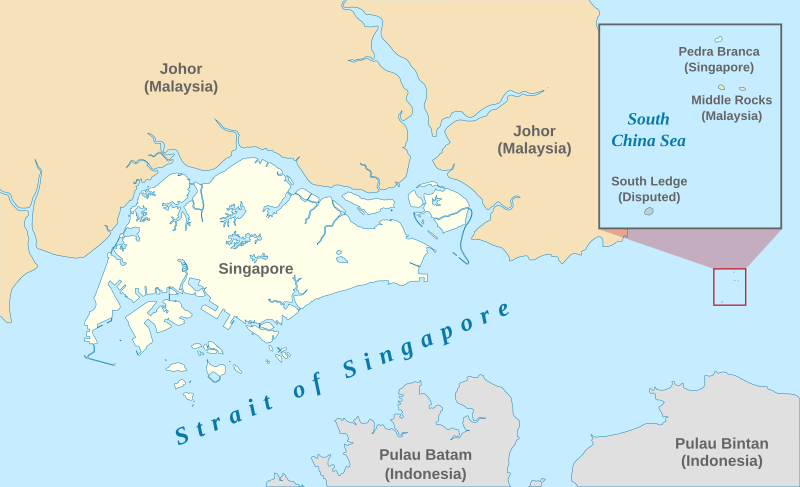
Descripción: A map showing the approximate location of the island of Pedra Branca, which is under the sovereignty of Singapore, at the eastern end of the Singapore Strait where it meets the South China Sea. Near it are the maritime features Middle Rocks (under Malaysian sovereignty) and South Ledge, and the coasts of Johor, Malaysia, and Bintan, Indonesia.
Título: Pedra Branca Map
Créditos: Self-made, modified from Image:Singapore Outline.svg.
Autor(a): Jappalang.
Permiso: PD-Self.
Términos de Uso: Dominio Público
Licencia: Dominio Público
¿Se exige la atribución?: No
Usos del archivo
No hay páginas que enlacen a esta imagen.

Todo el contenido de los artículos de la Enciclopedia Kiddle (incluidas las imágenes) se puede utilizar libremente para fines personales y educativos bajo la licencia Atribución-CompartirIgual a menos que se indique lo contrario.