
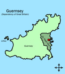
Archivo: Parishes in Guernsey (St Peter Port shaded)

Tamaño de esta previsualización: 531 × 599 píxeles. Otras resoluciones: 213 × 240 píxeles | 586 × 661 píxeles.
Archivo original (586 × 661 píxeles; tamaño de archivo: 16 KB; tipo MIME: image/gif)
Description: This map shows the position of St Peter Port in relation to the rest of Guernsey. I drew it myself but it is based on the picture Parishes in Guernsey, which I also drew myself, and the picture: http://www.brennanandco.com/graphics/guernseymap.jpg
Title: Parishes in Guernsey (St Peter Port shaded)
Credit: Transferred from en.wikipedia to Commons by Premeditated Chaos using CommonsHelper.
Author: Tra at English Wikipedia
Usage Terms: Public domain
License: Public domain
Attribution Required?: No
Usos del archivo
La siguiente página enlaza a este archivo:
.GIF&oldid=873296)

Todo el contenido de los artículos de la Enciclopedia Kiddle (incluidas las imágenes) se puede utilizar libremente para fines personales y educativos bajo la licencia Atribución-CompartirIgual a menos que se indique lo contrario.
.GIF)