
Archivo: Ouachita Mountains topographic v1

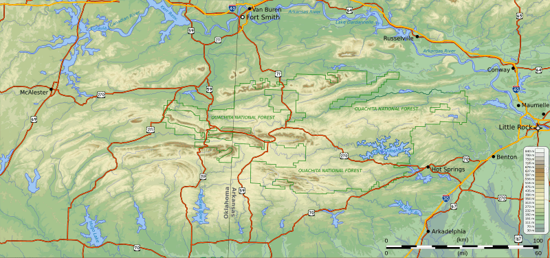
Description: Topographic map of the Ouachita Mountains in the U.S. states of Arkansas and Oklahoma. Also showing the Ouachita National Forest boundaries. Credits Produced with public domain data from the National Atlas of the United States, and incorporating public domain highway shields from Wikimedia.org. Projection UTM zone 15 North: EPSG:26915. A map highlighting the area in the United States covered by this map is at File:Ouachita Mountains topographic v1 locator.svg
Title: Ouachita Mountains topographic v1
Credit: Own work
Author: Kbh3rd
Usage Terms: Creative Commons Attribution-Share Alike 3.0
License: CC BY-SA 3.0
License Link: http://creativecommons.org/licenses/by-sa/3.0
Attribution Required?: Yes
Usos del archivo
La siguiente página enlaza a este archivo:
