
Archivo: Northlasv
Tamaño de esta previsualización: 800 × 292 píxeles. Otras resoluciones: 320 × 117 píxeles | 1011 × 369 píxeles.
Archivo original (1011 × 369 píxeles; tamaño de archivo: 123 KB; tipo MIME: image/jpeg)
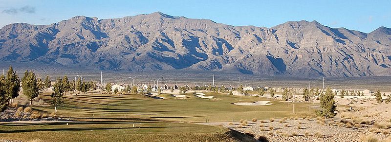
Description: The southern section of the Las Vegas Range, and the Aliante Golf Club in the Las Vegas Valley — in Clark County, southern Nevada. The highest point of the range is Gass Peak at 6,943 feet (2,116 m) (left-center in photo). The range has a long north-south ridgeline-(lower in elevation), with the southern end forming a en:massif, probably caused by the same transform (strike/slip) fault that created Red Rock Park west of Las Vegas, and causing the uplift of Mount Charleston, (with its seabed fossils).
Title: Northlasv
Credit: Own work
Author: Meridethmyers
Usage Terms: Public domain
License: Public domain
Attribution Required?: No
Usos del archivo
Las siguientes páginas enlazan a este archivo:

Todo el contenido de los artículos de la Enciclopedia Kiddle (incluidas las imágenes) se puede utilizar libremente para fines personales y educativos bajo la licencia Atribución-CompartirIgual a menos que se indique lo contrario.