
Archivo: Northeast Thailand geology
No disponible en mayor resolución.
Northeast_Thailand_geology.jpg (518 × 570 píxeles; tamaño de archivo: 51 KB; tipo MIME: image/jpeg)
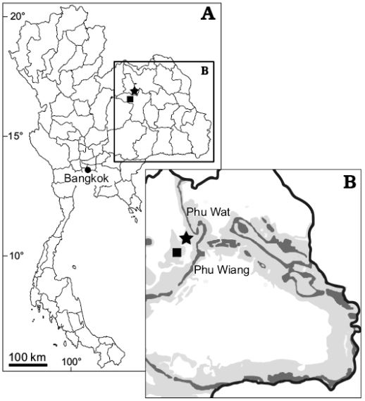
Description: Map of Thailand (A) and close-up of northeastern Thailand (B) showing the location of Phu Wiang locality, Khon Kaen Province (square) and Phu Wat locality, Nong Bua Lamphu Province (star). Dark gray, Sao Khua Formation outcrops, light gey, Phu Kradung and Khok Kruat formations.
Title: Northeast Thailand geology
Credit: https://www.app.pan.pl/archive/published/app64/app005402018.pdf
Author: Adun Samathi, Phornphen Chanthasit, and P. Martin Sander
Usage Terms: Creative Commons Attribution 4.0
License: CC BY 4.0
License Link: https://creativecommons.org/licenses/by/4.0
Attribution Required?: Yes
Usos del archivo
La siguiente página enlaza a este archivo:

Todo el contenido de los artículos de la Enciclopedia Kiddle (incluidas las imágenes) se puede utilizar libremente para fines personales y educativos bajo la licencia Atribución-CompartirIgual a menos que se indique lo contrario.