
Archivo: New-Map-Francophone World

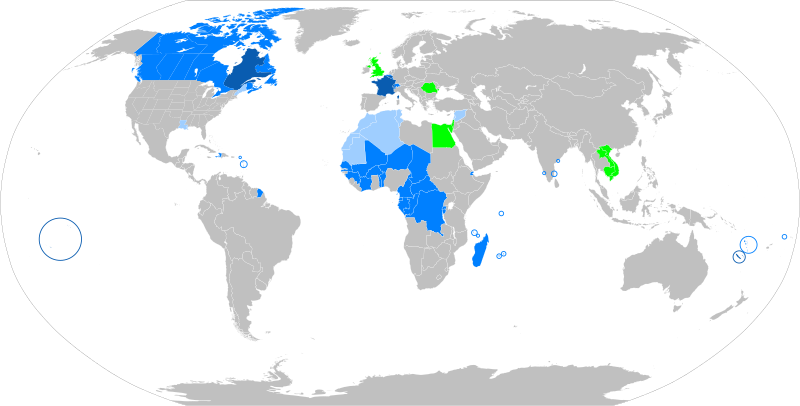
Descripción: The French language in the world States where French is the majority native language States where it is an official or administrative language States where it is a minority or secondary language States that have a local francophone minority The following things have been changed from the old "Map-Francophone World.png": Vietnam, Cambodia and Laos are no longer colored in light blue, this is because French is not used there very much these days. Mauritania, Morocco, Algeria, and Tunisia have been colored light blue, because the French language is widely used. There are even more French speakers in those countries where French is the official language. The Western Sahara has been colored light blue, due to the increased use of French there. A green square has been added in London to recognize the French-speaking minority there.
Título: Map-Francophone World
Créditos: Trabajo propio
Autor(a): aaker (original PNG file: https://commons.wikimedia.org/wiki/File:New-Map-Francophone_World.PNG )
Términos del Uso: Creative Commons Attribution-Share Alike 4.0
Licencia: CC BY-SA 4.0
Enlace de Licencia: https://creativecommons.org/licenses/by-sa/4.0
¿Se exige la atribución?: Sí
Usos del archivo
El siguiente archivo es un duplicado de éste (más detalles):
Las siguientes páginas enlazan a este archivo:
