
Archivo: NZCensus2013-Maori
Tamaño de esta previsualización: 798 × 600 píxeles. Otras resoluciones: 319 × 240 píxeles | 5000 × 3759 píxeles.
Archivo original (5000 × 3759 píxeles; tamaño de archivo: 1013 KB; tipo MIME: image/png)
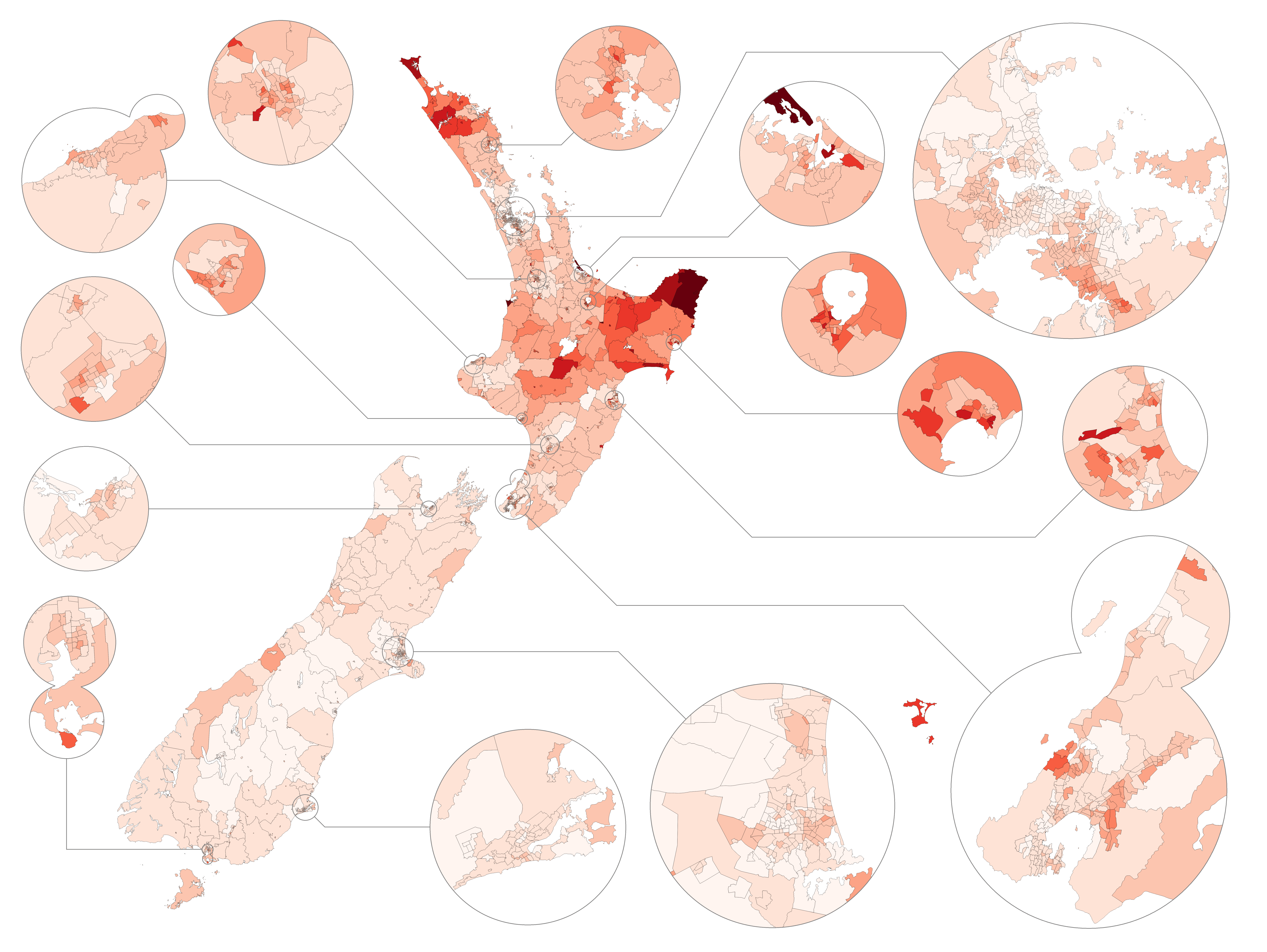
Descripción: Map showing the percentage of people in each New Zealand census area unit as of 2013 who identified themselves (not necessarily exclusively) with the Māori ethnic group. Data from Statistics NZ; made partly using QGIS. Less than 5% More than 5% More than 10% More than 20% More than 30% More than 40% More than 50% More than 60% More than 70% More than 80%
Título: NZCensus2013-Maori
Créditos: Trabajo propio
Autor(a): Vardion
Términos de Uso: Creative Commons Attribution-Share Alike 3.0
Licencia: CC BY-SA 3.0
Enlace de Licencia: https://creativecommons.org/licenses/by-sa/3.0
¿Se exige la atribución?: Sí
Usos del archivo
La siguiente página enlaza a este archivo:

Todo el contenido de los artículos de la Enciclopedia Kiddle (incluidas las imágenes) se puede utilizar libremente para fines personales y educativos bajo la licencia Atribución-CompartirIgual a menos que se indique lo contrario.