
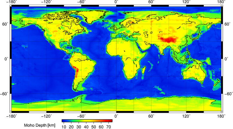
Archivo: Mohomap

Tamaño de esta previsualización: 800 × 444 píxeles. Otras resoluciones: 320 × 178 píxeles | 3282 × 1821 píxeles.
Archivo original (3282 × 1821 píxeles; tamaño de archivo: 272 KB; tipo MIME: image/png)
Description: This is a geophysical map showing the position of the Moho discontinuity across the Earth. The Moho is the boundary between the Earth's crust and the mantle. Search "Mohorovičić discontinuity" for more information. This map was constructed using the Crust 1.0 model and Generic Mapping Tools (GMT) for Linux. It was done at the Christian-Albrechts University of Kiel, Germany.
Title: Mohomap
Credit: Own work
Author: AllenMcC.
Usage Terms: Creative Commons Attribution-Share Alike 3.0
License: CC BY-SA 3.0
License Link: http://creativecommons.org/licenses/by-sa/3.0
Attribution Required?: Yes
Usos del archivo
Las siguientes páginas enlazan a este archivo:

Todo el contenido de los artículos de la Enciclopedia Kiddle (incluidas las imágenes) se puede utilizar libremente para fines personales y educativos bajo la licencia Atribución-CompartirIgual a menos que se indique lo contrario.