
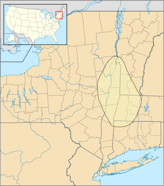
Archivo: Mohican distribution map

Descripción: Approximate range of Mohican (Mahican) native americans
Título: Mohican distribution map
Créditos: Self created using Inkscape. Map outline is a composite of :file:US Locator Blank2.svg (Originally uploaded at English Wikipedia by en:User:Papayoung and en:User:Ilmari Karonen, modified by NordNordWest at Commons. Originally created by en:User:Wapcaplet), :file:USA New York location map.svg{NordNordWest at Commons), :file:USA Vermont location map.svg (Alexrk2 at Commons), :file:USA Massachusetts location map.svg (Alexrk2 at Commons) and :file:USA Connecticut location map.svg (Alexrk2 at Commons). The map data for the Mohican range was obtained from Native Languages of the Americas, "Mohican Culture and History" and the various map sub-pages there.
Autor(a): SpinningSpark
Términos de Uso: Creative Commons Attribution-Share Alike 3.0
Licencia: CC BY-SA 3.0
Enlace de Licencia: https://creativecommons.org/licenses/by-sa/3.0
¿Se exige la atribución?: Sí
Usos del archivo
La siguiente página enlaza a este archivo:
