
Archivo: Mindanao1900 Distributionoftheraces

Tamaño de esta previsualización: 528 × 599 píxeles. Otras resoluciones: 211 × 240 píxeles | 810 × 919 píxeles.
Archivo original (810 × 919 píxeles; tamaño de archivo: 186 KB; tipo MIME: image/jpeg)
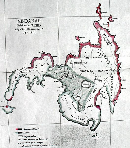
Descripción: A 1900 map of Mindanao Island, and adjacent islets of the larger Mindanao islands group, in the southern Philippines. Map shows the distribution of races and tribes of Mindanao in their traditional homeland — in 1900, 2 years after 300 years of Spanish colonialism ended with American acquisition. From the Annual Report of US War Department for 1900, which is one of the earliest maps of Mindanao drawn by the Americans.
Título: Mindanao1900 Distributionoftheraces
Créditos: http://www.morolandhistory.com/01.Map%20Gallery/7.Distribution_of_the_Races_Mindanao_1900.htm
Autor(a): US War Department
Términos de Uso: Dominio Público
Licencia: Dominio Público
¿Se exige la atribución?: No
Usos del archivo
La siguiente página enlaza a este archivo:

Todo el contenido de los artículos de la Enciclopedia Kiddle (incluidas las imágenes) se puede utilizar libremente para fines personales y educativos bajo la licencia Atribución-CompartirIgual a menos que se indique lo contrario.