
Archivo: Metropolitan Areas of Mexico

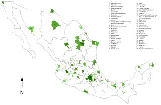
Descripción: This map gives the location of the 55 Metropolitan Areas identified in Mexico as per the 2004 definition of the term (See source. Municipality limits and population figures are those reported in the 2000 General Population and Housing Census by INEGI. For more information see the related List of metropolitan areas of Mexico article. LegendThe shading of each metro area corresponds to its population based on figures from the 2000 population census. (#287C00) 3 million or more inhabitants. (#449014) 1 million to 2,999,999 (#58A42C) 500,000 to 999,999 (#6CBC44) 250,000 to 499,999 (#80D05C) 100,000 to 249,999 Category:Maps of Mexico
Título: Metropolitan Areas of Mexico
Créditos: Transferido desde en.wikipedia a Commons por Rehman usando CommonsHelper. This map was drawn by User:Rune.welsh using Inkscape. All the data used in the preparation of this map were obtained from the publication Delimitación de las zonas metropolitanas de México (ISBN 970-13-3675-5) published in Mexico by INEGI in 2004.
Autor(a): Rune.welsh de Wikipedia en inglés
Términos de Uso: Creative Commons Attribution 2.5
Licencia: CC BY 2.5
Enlace de Licencia: https://creativecommons.org/licenses/by/2.5
¿Se exige la atribución?: Sí
Usos del archivo
La siguiente página enlaza a este archivo:
