
Archivo: MediterráneoOrientalEn1389-es

Tamaño de esta previsualización PNG del archivo SVG: 800 × 529 píxeles. Otra resolución: 320 × 212 píxeles.
Archivo original (archivo SVG, nominalmente 2218 × 1468 píxeles, tamaño de archivo: 1,29 MB)
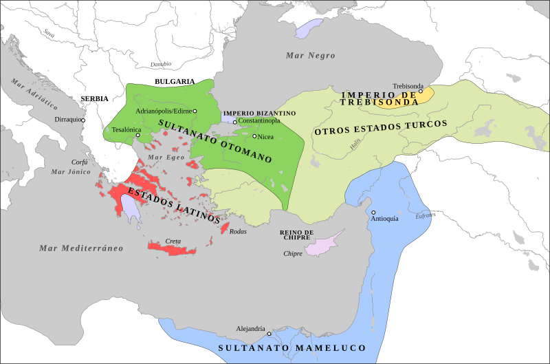
Descripción: Map of the Middle East c.1389. Serbia has been reduced to vassal status and Byzantium (orange) consists only of Constantinople and a few outer posts. Following the occupation of Gallipoli, the Ottomans (dark green) rapidly spread across the Balkans giving them a major advantage over their Turkic (green) rivals in Anatolia.
Título: MediterráneoOrientalEn1389-es
Créditos: 1389 Mediterranean Sea.PNG
Autor(a): 1389 Mediterranean Sea.PNG: Shizhao derivative work: Rowanwindwhistler (discusión)
Términos de Uso: Creative Commons Attribution-Share Alike 4.0
Licencia: CC BY-SA 4.0
Enlace de Licencia: https://creativecommons.org/licenses/by-sa/4.0
¿Se exige la atribución?: Sí
Usos del archivo
Las siguientes páginas enlazan a este archivo:

Todo el contenido de los artículos de la Enciclopedia Kiddle (incluidas las imágenes) se puede utilizar libremente para fines personales y educativos bajo la licencia Atribución-CompartirIgual a menos que se indique lo contrario.