
Archivo: Mazama bathymetry survey map
No disponible en mayor resolución.
Mazama_bathymetry_survey_map.jpg (600 × 345 píxeles; tamaño de archivo: 61 KB; tipo MIME: image/jpeg)
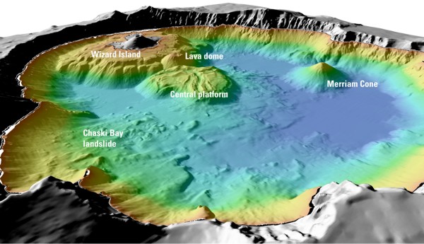
Description: USGS image from "Mount Mazama and Crater Lake: Growth and Destruction of a Cascade Volcano" Image caption at source: "Details of features beneath the surface of Crater Lake constructed using data from the 2000 bathymetry survey. Colors range from orange to blue with increasing water depth."
Title: Mazama bathymetry survey map
Usage Terms: Public domain
License: Public domain
Attribution Required?: No
Usos del archivo
La siguiente página enlaza a este archivo:

Todo el contenido de los artículos de la Enciclopedia Kiddle (incluidas las imágenes) se puede utilizar libremente para fines personales y educativos bajo la licencia Atribución-CompartirIgual a menos que se indique lo contrario.