
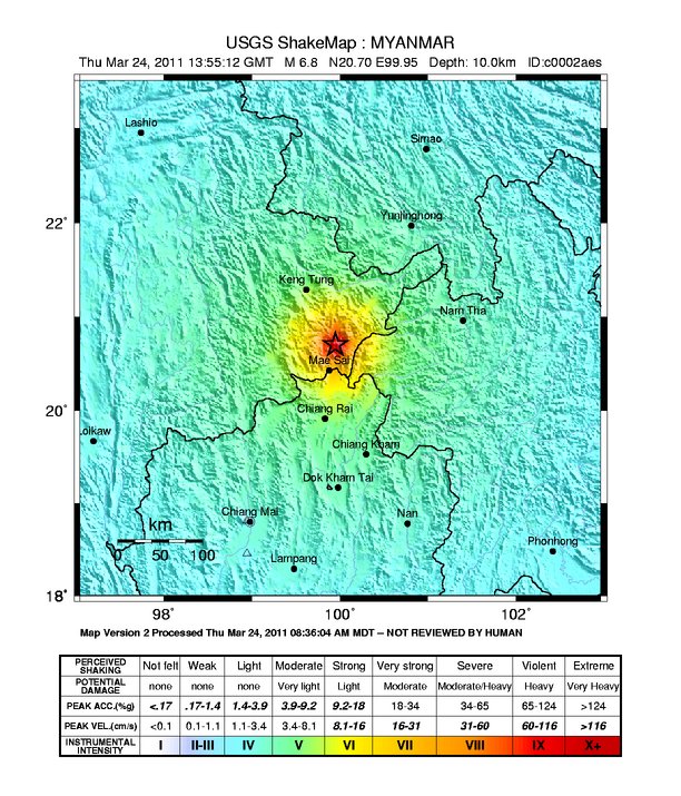
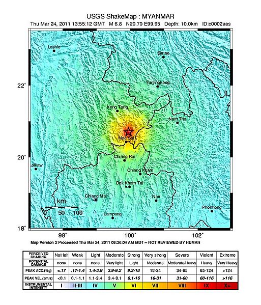
Archivo: Mar-2011 Burma-earthquake Shakemap
Tamaño de esta previsualización: 513 × 599 píxeles. Otras resoluciones: 205 × 240 píxeles | 612 × 715 píxeles.
Archivo original (612 × 715 píxeles; tamaño de archivo: 144 KB; tipo MIME: image/jpeg)
Description: USGS ShakeMap of 2011 Myanmar (Burma) earthquake, affecting four countries.
Title: Mar-2011 Burma-earthquake Shakemap
Credit: https://earthquake.usgs.gov/earthquakes/shakemap/global/shake/c0002aes/
Author: United States Geological Survey
Permission: This image is in the public domain in the United States because it only contains materials that originally came from the United States Geological Survey, an agency of the United States Department of the Interior. For more information, see the official USGS copyright policy.
Usage Terms: Public domain
License: Public domain
Attribution Required?: No
Usos del archivo
La siguiente página enlaza a este archivo:

Todo el contenido de los artículos de la Enciclopedia Kiddle (incluidas las imágenes) se puede utilizar libremente para fines personales y educativos bajo la licencia Atribución-CompartirIgual a menos que se indique lo contrario.