
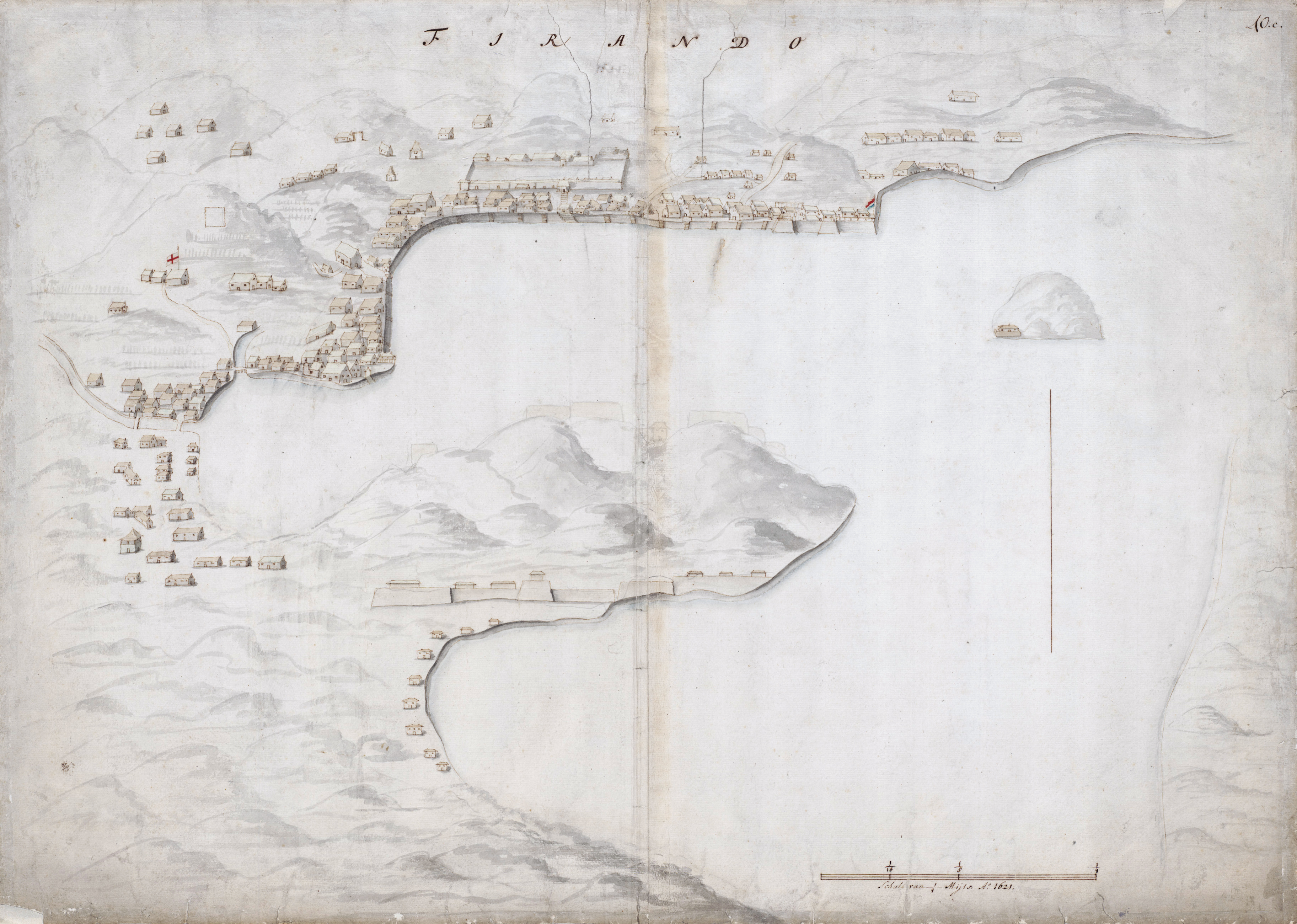
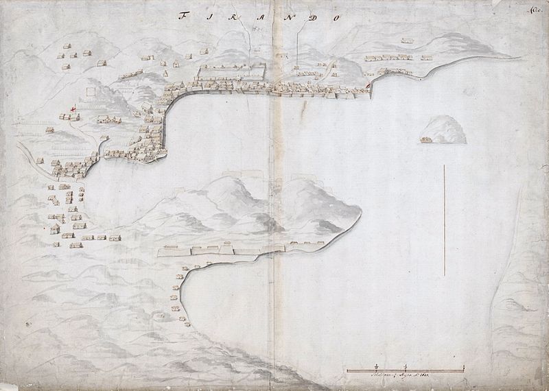
Archivo: Map of the bay of Hirado
Tamaño de esta previsualización: 800 × 570 píxeles. Otras resoluciones: 320 × 228 píxeles | 3649 × 2599 píxeles.
Archivo original (3649 × 2599 píxeles; tamaño de archivo: 2,73 MB; tipo MIME: image/jpeg)
Description: Topographical map of the bay of Hirado in 1621. To the right on the shore-line, the en:Dutch East India Company trading post is marked with the red-white-blue flag of the Netherlands. To the far left, somewhat back from the shore-line, notice the white flag with the red cross, possibly the en:St George's Cross of England. The English factory in Hirado was established in 1613. Richard Cocks was appointed as chief merchant. The factory was eventually closed in 1623
Title: Map of the bay of Hirado
Credit: Nationaal Archief Atlas Amsterdam van Isaac de Graaff
Author: Unknown
Usage Terms: Public domain
License: Public domain
Attribution Required?: No
Usos del archivo
La siguiente página enlaza a este archivo:

Todo el contenido de los artículos de la Enciclopedia Kiddle (incluidas las imágenes) se puede utilizar libremente para fines personales y educativos bajo la licencia Atribución-CompartirIgual a menos que se indique lo contrario.