
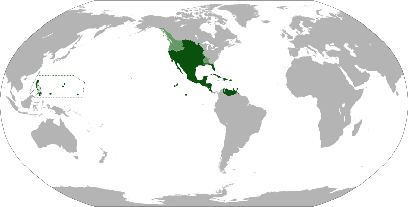
Archivo: Map of the Viceroyalty of New Spain

Descripción: Anachronistic map of New Spain, built from Image:New_Spain.png by myself and released on multi-licence (GFDL and CC-BY 2.5). This image includes the territory of Louisiana, annexed to the Spanish Empire in 1763 after the Seven Years' War, but then given back to France in 1801. The areas in light green were territories claimed by Spain.
Título: Map of the Viceroyalty of New Spain
Créditos: Trabajo propio File:BlankMap-World-90W.svg File:New Spain.png File:Nueva España 1795.png File:Spanish Provinces in the Pacific.png
Autor(a): Eddo
Términos de Uso: Creative Commons Attribution-Share Alike 3.0
Licencia: CC BY-SA 3.0
Enlace de Licencia: https://creativecommons.org/licenses/by-sa/3.0
¿Se exige la atribución?: Sí
Usos del archivo
Las siguientes páginas enlazan a este archivo:
