
Archivo: Map of the Periplus of the Erythraean Sea
Tamaño de esta previsualización: 800 × 438 píxeles. Otras resoluciones: 320 × 175 píxeles | 3507 × 1921 píxeles.
Archivo original (3507 × 1921 píxeles; tamaño de archivo: 1,58 MB; tipo MIME: image/jpeg)
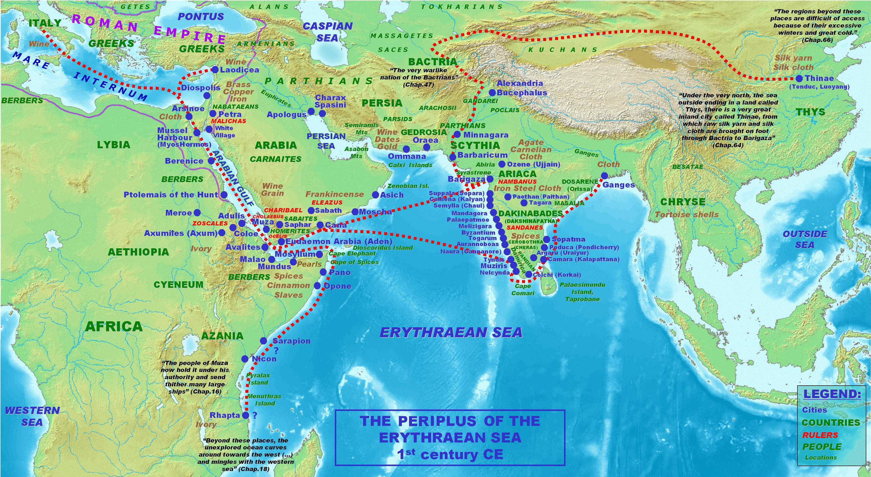
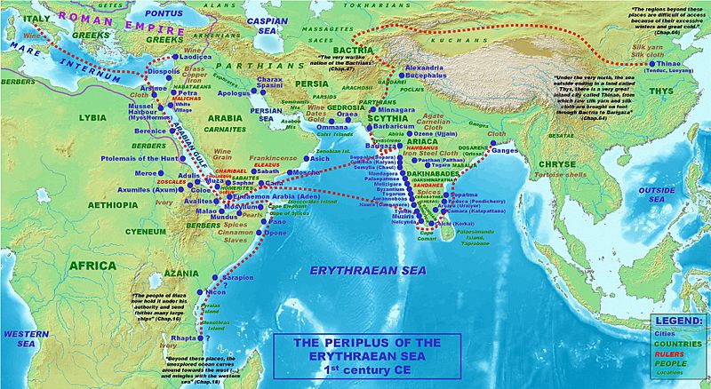
Description: Locations, names and routes of the Periplus of the Erythraean Sea (1st century CE).
Title: Map of the Periplus of the Erythraean Sea
Credit: self-made, background topographical map from Wikipedia Commons Image:Topographic30deg N0E60.png
Author: PHGCOM
Usage Terms: Creative Commons Attribution-Share Alike 4.0
License: CC BY-SA 4.0
License Link: https://creativecommons.org/licenses/by-sa/4.0
Attribution Required?: Yes
Usos del archivo
La siguiente página enlaza a este archivo:

Todo el contenido de los artículos de la Enciclopedia Kiddle (incluidas las imágenes) se puede utilizar libremente para fines personales y educativos bajo la licencia Atribución-CompartirIgual a menos que se indique lo contrario.