
Archivo: Map of the Auckland urban area, 2009, cropped
Tamaño de esta previsualización: 479 × 599 píxeles. Otras resoluciones: 192 × 240 píxeles | 819 × 1024 píxeles.
Archivo original (819 × 1024 píxeles; tamaño de archivo: 170 KB; tipo MIME: image/png)
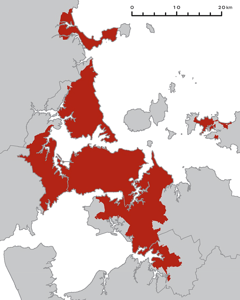
Description: A map of the Auckland region with the "land within Metropolitan Urban Limit" in red. The existing region and district boundaries are shown with grey lines; these are no longer current. North is at the top. The coastline shown around Puketutu Island, east of Mangere, is inaccurate. It shows all the area between the island and the mainland (formerly occupied by sewage treatment ponds) as land.
Title: Map of the Auckland urban area, 2009, cropped
Credit: Map_of_the_Auckland_urban_area,_2009.jpg
Author: Map_of_the_Auckland_urban_area,_2009.jpg: Royal Commission on Auckland Governance
Usage Terms: Public domain
License: Public domain
Attribution Required?: No
Usos del archivo
La siguiente página enlaza a este archivo:

Todo el contenido de los artículos de la Enciclopedia Kiddle (incluidas las imágenes) se puede utilizar libremente para fines personales y educativos bajo la licencia Atribución-CompartirIgual a menos que se indique lo contrario.