
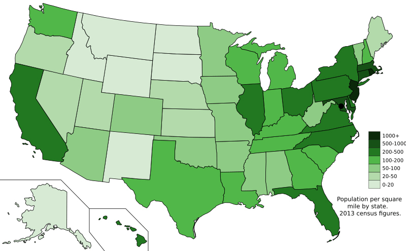
Archivo: Map of states showing population density in 2013

Tamaño de esta previsualización PNG del archivo SVG: 800 × 495 píxeles. Otra resolución: 320 × 198 píxeles.
Archivo original (archivo SVG, nominalmente 959 × 593 píxeles, tamaño de archivo: 50 KB)
Description: The US states with population density shown by people per square mile from the 2013 census, based on data from USCB.
Title: Map of states showing population density in 2013
Credit: Own work; Map is based on here.
Author: Ali Zifan
Usage Terms: Creative Commons Zero, Public Domain Dedication
License: CC0
License Link: http://creativecommons.org/publicdomain/zero/1.0/deed.en
Attribution Required?: No
Usos del archivo
La siguiente página enlaza a este archivo:

Todo el contenido de los artículos de la Enciclopedia Kiddle (incluidas las imágenes) se puede utilizar libremente para fines personales y educativos bajo la licencia Atribución-CompartirIgual a menos que se indique lo contrario.