
Archivo: Map of Tuileries and Louvre, as in c. 1589
Tamaño de esta previsualización: 800 × 537 píxeles. Otras resoluciones: 320 × 215 píxeles | 999 × 671 píxeles.
Archivo original (999 × 671 píxeles; tamaño de archivo: 776 KB; tipo MIME: image/png)
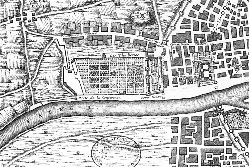
Descripción: Part of map of Paris, 1422–1589, showing close up of the Tuileries palace and the Louvre. The Louvre is to the right, on the north bank of the Seine, opposite where the city walls meet the river; the Tuileries palace, built (c. 1563–80) by Catherine de' Medici, is further along the bank to the left, with its gardens extending to the countryside and a view of open country to the south of the river. Henry IV (1589–1610) was to join the Louvre to the Tuileries with a gallery along the bank of the Seine (see Blunt, Art and Architecture in France: 1500–1700, Yale University Press, 1999 edition, ISBN 0300077351).
Términos de Uso: Dominio Público
Usos del archivo
La siguiente página enlaza a este archivo:

Todo el contenido de los artículos de la Enciclopedia Kiddle (incluidas las imágenes) se puede utilizar libremente para fines personales y educativos bajo la licencia Atribución-CompartirIgual a menos que se indique lo contrario.