
Archivo: Map of Peterloo Massacre
Tamaño de esta previsualización: 800 × 534 píxeles. Otras resoluciones: 320 × 214 píxeles | 2403 × 1605 píxeles.
Archivo original (2403 × 1605 píxeles; tamaño de archivo: 679 KB; tipo MIME: image/png)
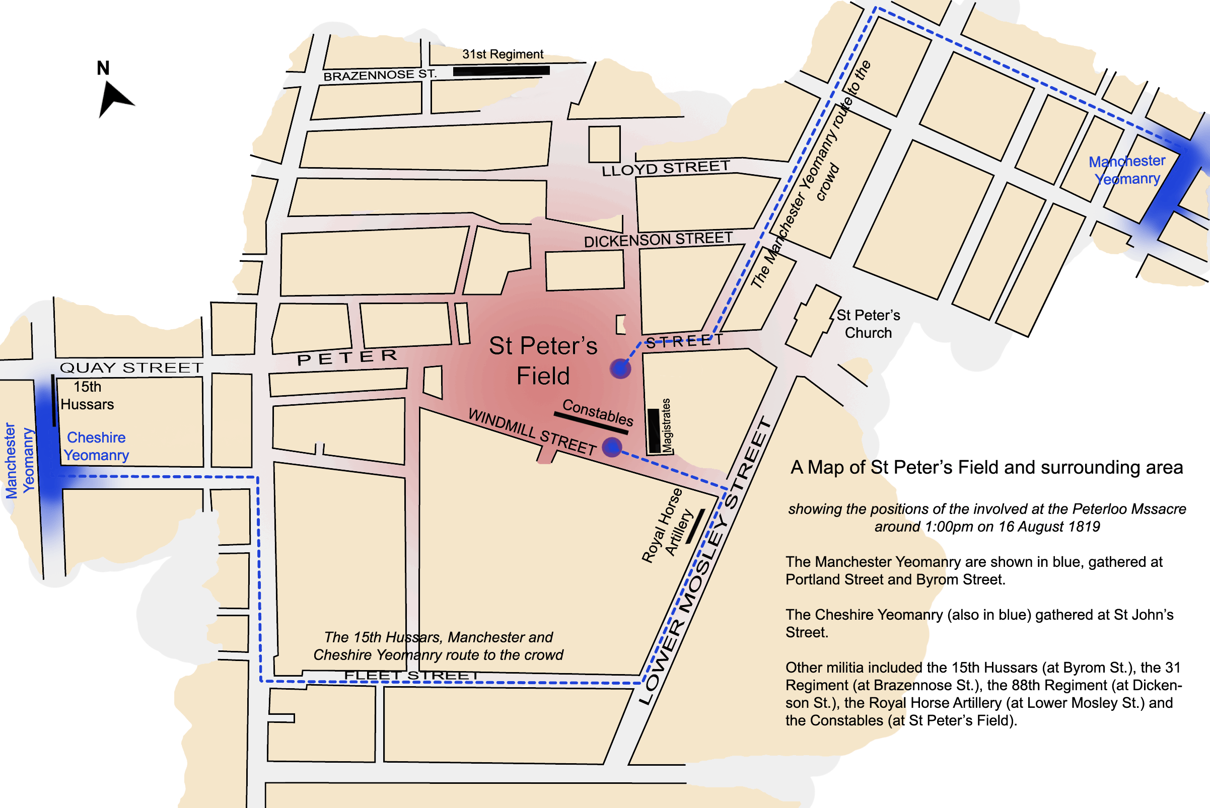
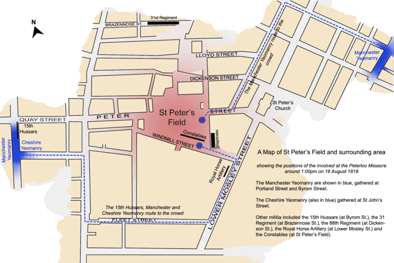
Description: A map of St Peter's Field, Manchester, England at the time of the Peterloo Massacre of 1819. This map, highlights the positions of those parties involved in the massacre as they were documented to have been at 1.00pm.
Title: Map of Peterloo Massacre
Credit: self-made but based on work in Reid, Robert (1989) The Peterloo Massacre, William Heinemann Ltd ISBN: 0434629014.
Author: Jhamez84
Usage Terms: Creative Commons Attribution 3.0
License: CC BY 3.0
License Link: http://creativecommons.org/licenses/by/3.0
Attribution Required?: Yes
Usos del archivo
La siguiente página enlaza a este archivo:

Todo el contenido de los artículos de la Enciclopedia Kiddle (incluidas las imágenes) se puede utilizar libremente para fines personales y educativos bajo la licencia Atribución-CompartirIgual a menos que se indique lo contrario.