
Archivo: Map of Montgomery County Ohio With Municipal and Township Labels

Tamaño de esta previsualización: 582 × 600 píxeles. Otras resoluciones: 233 × 240 píxeles | 1006 × 1037 píxeles.
Archivo original (1006 × 1037 píxeles; tamaño de archivo: 49 KB; tipo MIME: image/png)
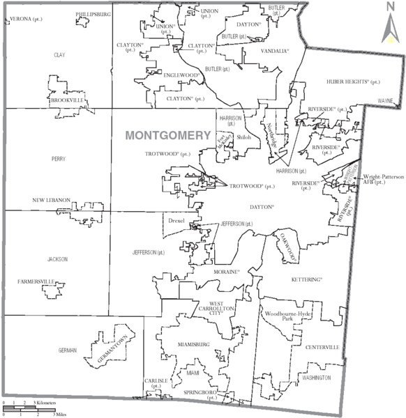
Descripción: Map of Montgomery County, Ohio, United States with township and municipal boundaries
Título: Map of Montgomery County Ohio With Municipal and Township Labels
Créditos: taken from US Census website [1] and modified by User:Ruhrfisch
Autor(a): US Census, Ruhrfisch
Permiso: US Census / US Government work is public domain, my modifications licensed under the GNU Free Documentation License
Términos de Uso: Creative Commons Attribution-Share Alike 3.0
Licencia: CC-BY-SA-3.0
Enlace de Licencia: http://creativecommons.org/licenses/by-sa/3.0/
¿Se exige la atribución?: Sí
Usos del archivo
La siguiente página enlaza a este archivo:

Todo el contenido de los artículos de la Enciclopedia Kiddle (incluidas las imágenes) se puede utilizar libremente para fines personales y educativos bajo la licencia Atribución-CompartirIgual a menos que se indique lo contrario.