
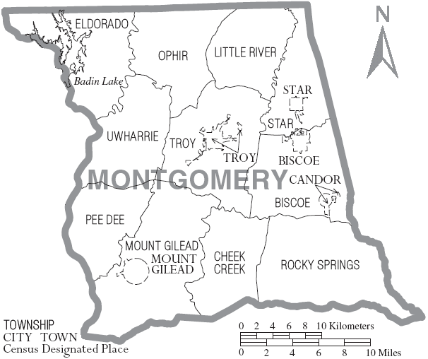
Archivo: Map of Montgomery County North Carolina With Municipal and Township Labels
No disponible en mayor resolución.
Map_of_Montgomery_County_North_Carolina_With_Municipal_and_Township_Labels.PNG (606 × 508 píxeles; tamaño de archivo: 47 KB; tipo MIME: image/png)
Description: Map of Montgomery County, North Carolina, United States with township and municipal boundaries
Title: Map of Montgomery County North Carolina With Municipal and Township Labels
Credit: taken from US Census website [1] and modified by User:Ruhrfisch
Author: US Census, Ruhrfisch
Permission: US Census / US Government work is public domain, my modifications licensed under the GNU Free Documentation License
Usage Terms: Public domain
License: Public domain
Attribution Required?: No
Usos del archivo
La siguiente página enlaza a este archivo:

Todo el contenido de los artículos de la Enciclopedia Kiddle (incluidas las imágenes) se puede utilizar libremente para fines personales y educativos bajo la licencia Atribución-CompartirIgual a menos que se indique lo contrario.