
Archivo: Map of Maguindanao 1521
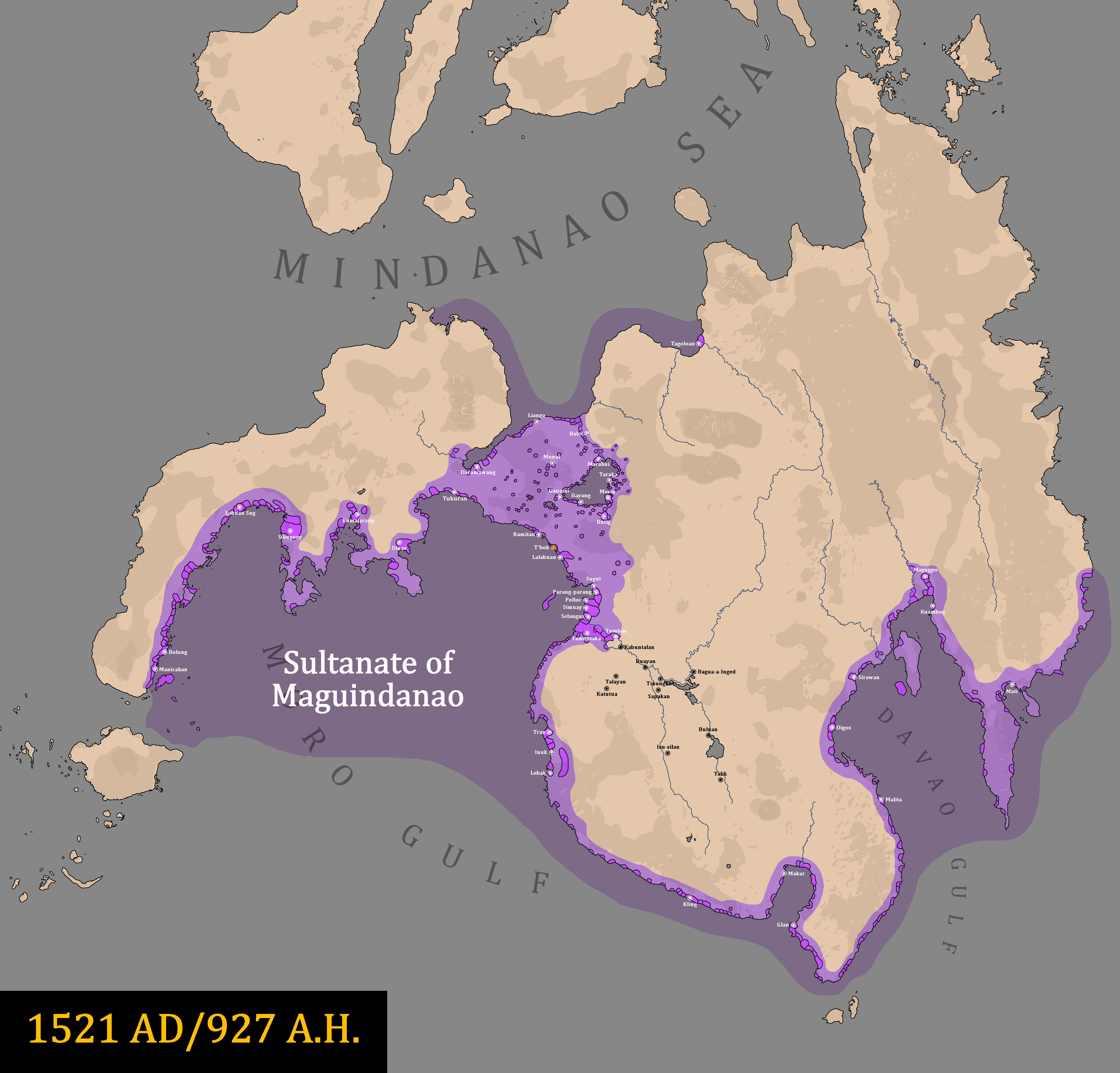
Descripción: The map of the Sultanate of Maguindanao in 1521.
Título: Map of Maguindanao 1521
Créditos: Original work by DeliriumMaps (Delirium333). The information was gathered from the following: Wikipedia 'We Are Many Nations: The Emergence of a Multi-Ethnic Maguindanao Sultanate' (1986) by Ruurdje Laarhoven 'Studies in Moro History, Law, and Religion' (1905) by Najeeb M. Saleeby No. 27. Mindanao Oriental. Islas Filipinas Observatorio de Manila. United States Coast and Geodetic Survey. No. 27. Longitud E. del Meridiano de Greenwich.' A. Hoen and Co. (1899) 'The Islamicity of Lanao Sultanate in the Philippines in the 17th Century as a State' (2018) by Sohayle M. Hadji Abdul Racman https://theroyalbaloirepresentative.wordpress.com/2011/09/14/confederation-of-sultanates-in-lanao/ https://borneohistory57.blogspot.com/2016/05/sultanate-of-buayan.html (use with caution) http://portaltotheplateau.blogspot.com/2014/01/polity-of-dulangan-manobo-part-1-of-2.html?m=1
Autor(a): Delirium333
Términos de Uso: Creative Commons Attribution-Share Alike 4.0
Licencia: CC BY-SA 4.0
Enlace de Licencia: https://creativecommons.org/licenses/by-sa/4.0
¿Se exige la atribución?: Sí
Usos del archivo
La siguiente página enlaza a este archivo:
