
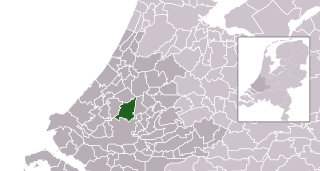
Archivo: Map - NL - Municipality code 1621 (2009)

Descripción: Location maps for the 441 municipalities in the Netherlands. Boundaries 1/1/2009 Automatically generated with script File name contains "Municipality code" (CBS-code) as specified in: [1] Created in svg using coordinate data derived from ESRI data published by Centraal Bureau voor de Statistiek, Voorburg/Heerlen. ([2]) Color coding and original design (slightly adpated by me) by user Mtcv (2006/2007) ([3]) El propietario de los derechos de autor de este archivo, Centraal Bureau voor de Statistiek, autoriza a cualquier persona a usarlo para cualquier propósito, siempre que el titular de los derechos de autor sea atribuido apropiadamente. La redistribución, la realización de trabajos derivados, el uso comercial y otro tipo de usos están permitidos. Atribución: Centraal Bureau voor de Statistiek Attribution Esta obra es libre y puede ser utilizada por cualquiera para cualquier propósito. Si usted desea utilizar este contenido fuera de Wikimedia, no necesitará pedir permiso mientras sigua las condiciones de la licencia explicitadas en esta página. Wikimedia ha recibido un correo electrónico que confirma que el titular de los derechos de autor ha aprobado la publicación y la reutilización de la obra bajo las condiciones que se mencionan en esta página. La correspondencia ha sido revisada por un miembro de OTRS y ha sido guardada en nuestro sistema. El texto de la correspondencia está disponible solo para voluntarios confiables bajo el Ticket #2007041210008226. Enlace al permiso: https://ticket.wikimedia.org/otrs/index.pl?Action=AgentTicketZoom&TicketNumber=2007041210008226 Find other files from the same ticket: This image is (in part or entirely) based on geographical data from Statistics Netherlands (Centraal Bureau voor de Statistiek). Digital geometry files in ESRI format can be downloaded from their website [4]. In particular, boundary data of statistical districts is based on either the Wijk- en buurtkaart 2005, or the Wijk- en buurtkaart 2003 ("CBS/TOPgrenzen"). Data on localities (bevolkingskernen) are from the publication Bevolkingskernen in Nederland 2001. Conditions of use (in Dutch): Bij visualisering van gegevens met behulp van het digitale bestand Wijk- en buurtkaart 2005 dient te worden vermeld:Bron: © 2006, Centraal Bureau voor de Statistiek / Topografische Dienst KadasterBij visualisering van gegevens met behulp van het digitale bestand CBS/TOPgrenzen dient te worden vermeld:Grenzen ondergrond: © 2003, Centraal Bureau voor de Statistiek/Topografische Dienst KadasterBij visualisering van gegevens met behulp van het digitale bestand "Bevolkingskernen 2001" dient te worden vermeld:Bron: © 2005, Centraal Bureau voor de StatistiekUnless otherwise specified, data on waterways and lakes are from the public domain Digital Chart of the World.
Título: Map - NL - Municipality code 1621 (2009)
Créditos: own work , using CBS data
Autor(a): Michiel1972 (talk) 23:59, 24 January 2009 (UTC)
Permiso: Attribution ShareAlike 3.0
Términos de Uso: Creative Commons Attribution-Share Alike 3.0
Licencia: CC BY-SA 3.0
Enlace de Licencia: https://creativecommons.org/licenses/by-sa/3.0
¿Se exige la atribución?: Sí
Usos del archivo
La siguiente página enlaza a este archivo:
.svg&oldid=3334540)

.svg)