
Archivo: Manitoba and Northwest Territories (1900)
Tamaño de esta previsualización: 800 × 581 píxeles. Otras resoluciones: 320 × 232 píxeles | 3510 × 2550 píxeles.
Archivo original (3510 × 2550 píxeles; tamaño de archivo: 9,76 MB; tipo MIME: image/jpeg)
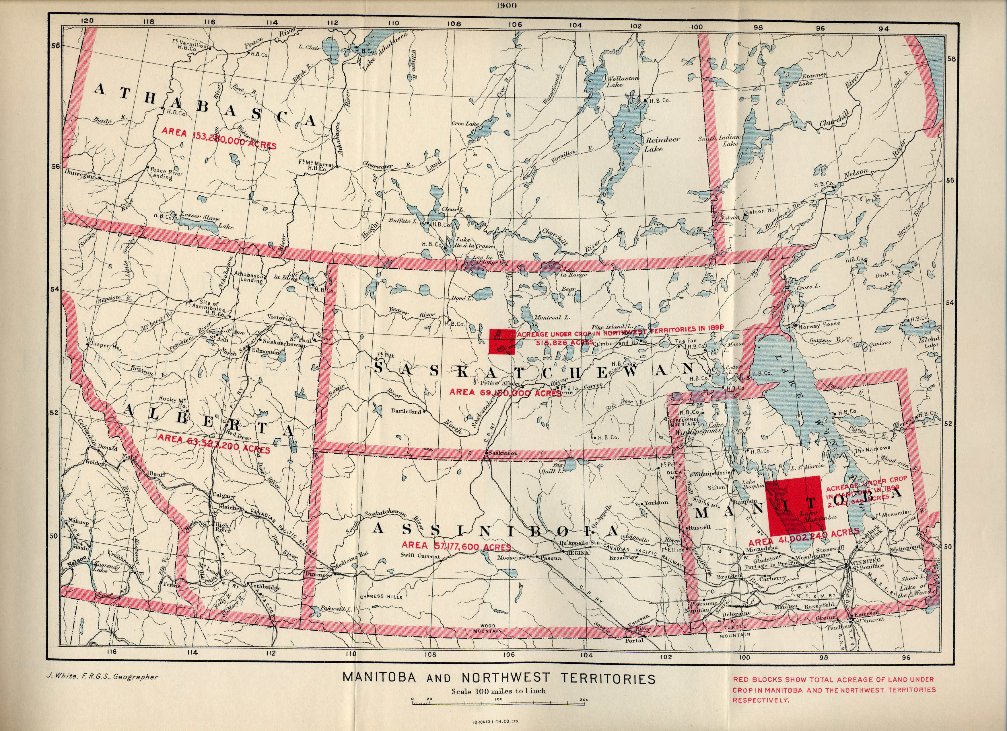
Description: The following is the author's description of the photograph quoted directly from the photograph's Flickr page."White, James. Manitoba and Northwest Territories [map]. 1:950,400. [Ottawa]: Dept. of the Interior, 1900. Red blocks show total acreage of land under crop in Manitoba and the Northwest Territories respectively. Shows size, in acres the areas of Athabasca, Alberta, Saskatchewan, Assiniboia and Manitoba in 1900.Source: University of Manitoba : Elizabeth Dafoe Library : Map Collection "
Author: [1]
Usage Terms: Creative Commons Attribution-Share Alike 3.0
License: CC-BY-SA-3.0
License Link: http://creativecommons.org/licenses/by-sa/3.0/
Attribution Required?: Yes
Usos del archivo
La siguiente página enlaza a este archivo:
.jpg&oldid=1473485)

Todo el contenido de los artículos de la Enciclopedia Kiddle (incluidas las imágenes) se puede utilizar libremente para fines personales y educativos bajo la licencia Atribución-CompartirIgual a menos que se indique lo contrario.
.jpg)