
Archivo: MEX orthographic

Tamaño de esta previsualización PNG del archivo SVG: 551 × 551 píxeles. Otra resolución: 240 × 240 píxeles.
Archivo original (archivo SVG, nominalmente 551 × 551 píxeles, tamaño de archivo: 2,26 MB)
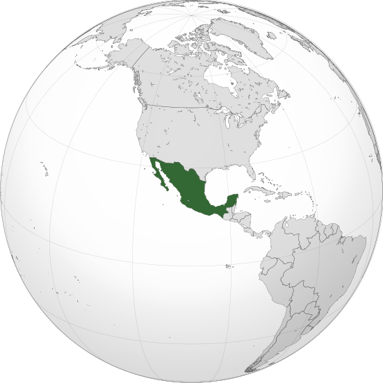
Description: A map of the hemisphere centred on -102, 23, using an orthographic projection, created using gringer's Perl script with Natural Earth Data (1:50000 resolution, simplified to 0.25px). Mexico is highlighted in green. Official territory. Claimed territories.
Title: MEX orthographic
Credit: Own work with Natural Earth Data This vector image was created with Inkscape.
Author: Addicted04
Usage Terms: Creative Commons Attribution-Share Alike 3.0
License: CC BY-SA 3.0
License Link: http://creativecommons.org/licenses/by-sa/3.0
Attribution Required?: Yes
Usos del archivo
La siguiente página enlaza a este archivo:

Todo el contenido de los artículos de la Enciclopedia Kiddle (incluidas las imágenes) se puede utilizar libremente para fines personales y educativos bajo la licencia Atribución-CompartirIgual a menos que se indique lo contrario.