
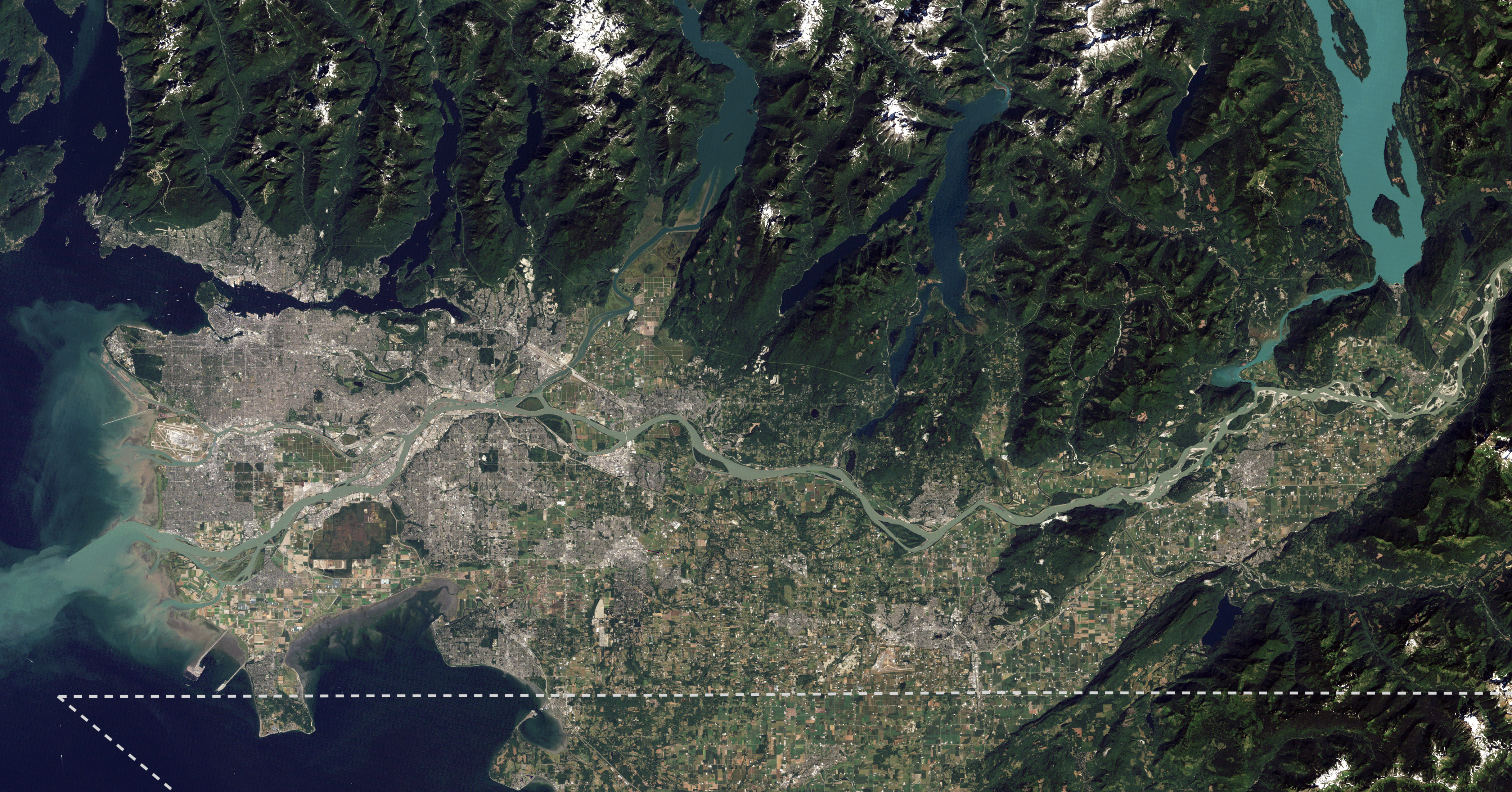
Archivo: Lower Mainland of British Columbia, 2012
Tamaño de esta previsualización: 800 × 419 píxeles. Otras resoluciones: 320 × 168 píxeles | 4200 × 2200 píxeles.
Archivo original (4200 × 2200 píxeles; tamaño de archivo: 3,01 MB; tipo MIME: image/jpeg)
Description: I took NASA's beautiful satellite image of the Fraser Lowland from 2012 and cropped into the core area of the Lower Mainland. I also added an approximate Canada-US border line meant for visual reference. This image is meant to replace an older satellite image that outlining the Lower Mainland in red.
Title: Lower Mainland of British Columbia, 2012
Credit: The Big Muddy, Western Edition
Author: NASA Goddard Space Flight Center from Greenbelt, MD, USA
Usage Terms: Creative Commons Attribution 2.0
License: CC BY 2.0
License Link: https://creativecommons.org/licenses/by/2.0
Attribution Required?: Yes
Usos del archivo
La siguiente página enlaza a este archivo:

Todo el contenido de los artículos de la Enciclopedia Kiddle (incluidas las imágenes) se puede utilizar libremente para fines personales y educativos bajo la licencia Atribución-CompartirIgual a menos que se indique lo contrario.