
Archivo: Louisiade archipelago

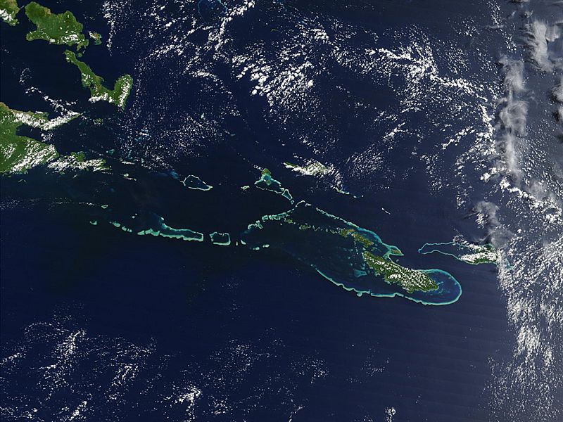
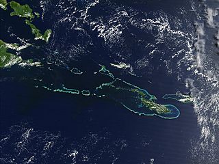
Descripción: Off the southeast tip of Papua New Guinea lies a string of small volcanic islands and coral reefs collectively called the Louisiade Archipelago. This true-color MODIS image from September 11, 2002, is centered on the island chain, with Papua New Guinea at the left edge. Moving westward from eastern end of the chain are the islands of Rossel and Tagula. (Misima Island, which harbors the largest village in the region, is obscured by a patch of clouds northeast of image center.) To the north of the chain lies the Solomon Sea, and to the south is the Coral Sea. Most of the undisturbed land is covered by tropical rainforest, and despite their small size, the islands harbor a number of plant and animal species found nowhere else.
Título: Louisiade archipelago
Créditos: Transferred from en.wikipedia
Autor(a): NASA
Términos de Uso: Dominio Público
Licencia: Dominio Público
¿Se exige la atribución?: No
Usos del archivo
La siguiente página enlaza a este archivo:
