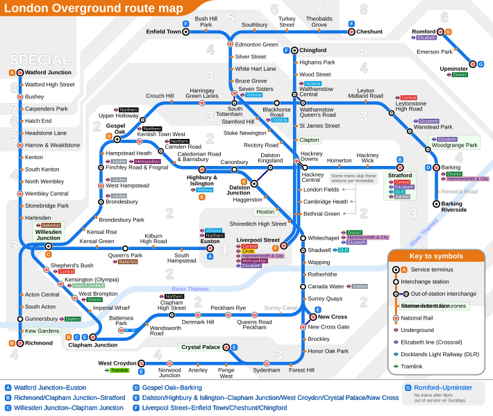
Archivo: London Overground map sb

Descripción: London Overground topological network map. Letters designated to routes are not official, these are applied by the author for easier identification in this map only. The SVG source provides a switch for hiding/showing the fare zones in the background. Clicking the line or the line name in the key will highlight the line in question in blue. This effect can be cancelled globally by clicking the background/fare zones. These functions are not available to the PNG or PDF versions.
Título: London Overground map sb
Créditos: Trabajo propio
Autor(a): user:Sameboat
Permiso: Puedes usar la licencia que prefieras.
Términos de Uso: Creative Commons Attribution-Share Alike 3.0
Licencia: CC BY-SA 3.0
Enlace de Licencia: https://creativecommons.org/licenses/by-sa/3.0
¿Se exige la atribución?: Sí
Usos del archivo
La siguiente página enlaza a este archivo:

