
Archivo: Locmap-PriceIsland
No disponible en mayor resolución.
Locmap-PriceIsland.png (301 × 236 píxeles; tamaño de archivo: 35 KB; tipo MIME: image/png)
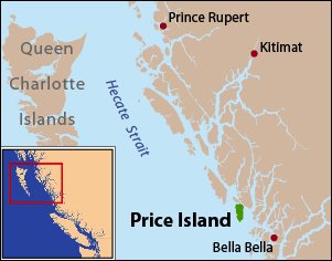
Description: This is a locator map of Price Island. I, Pfly, made it with ArcGIS, Adobe Illustrator, and Adobe Photoshop. The coastline data is from the Digital Chart of the World.
Title: Locmap-PriceIsland
Credit: Own work
Author: Pfly
Usage Terms: Creative Commons Attribution-Share Alike 3.0
License: CC BY-SA 3.0
License Link: https://creativecommons.org/licenses/by-sa/3.0
Attribution Required?: Yes
Usos del archivo
La siguiente página enlaza a este archivo:

Todo el contenido de los artículos de la Enciclopedia Kiddle (incluidas las imágenes) se puede utilizar libremente para fines personales y educativos bajo la licencia Atribución-CompartirIgual a menos que se indique lo contrario.