
Archivo: Lesser Sunda Islands en
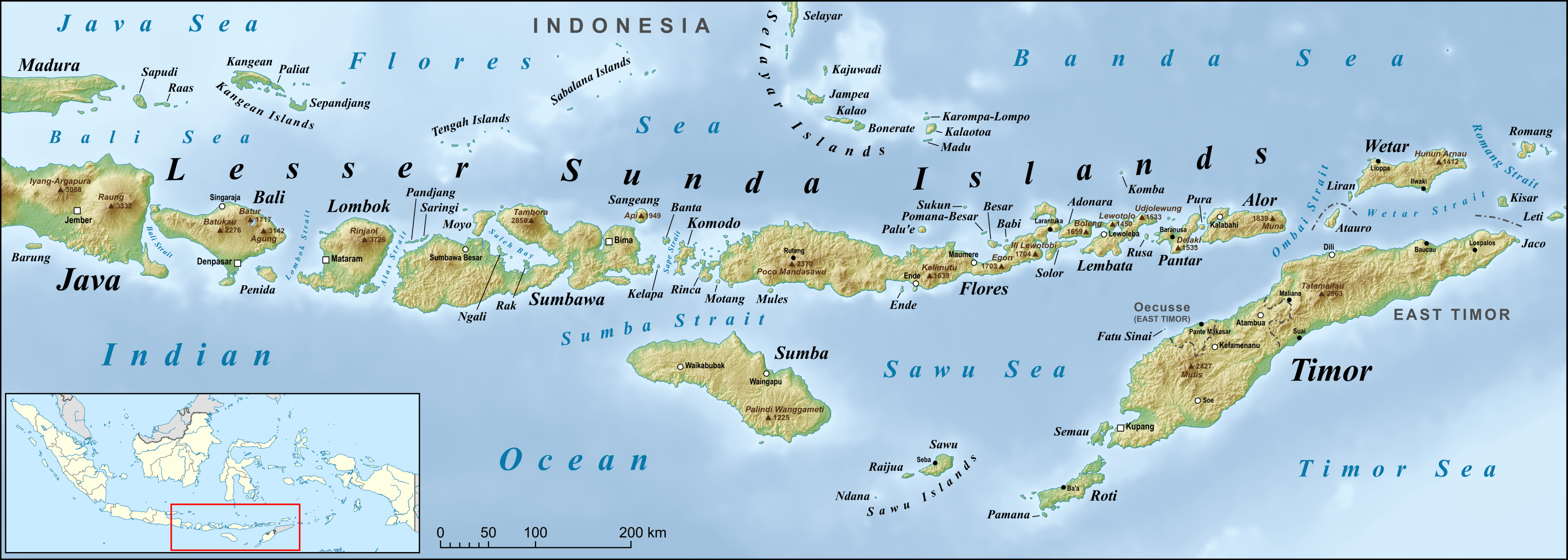
Descripción: Map of Lesser Sunda Islands, including Bali, Lombok, Sumbawa, Flores, Lembata, Pantar, Sumba, Savu, Rote Island and Timor, also Wetar, the Kangean Islands, the Tengah Islands, the Sabalana Islands and the Selayar Islands
Título: Lesser Sunda Islands en
Créditos: own work, used: GMT and SRTM3V2 File:Indonesia location map.svg by User:Uwe Dedering Dili, by U.S. Army Map Service Sedjorong, by U.S. Army Map Service Waikababubak, by U.S. Army Map Service Bima, by U.S. Army Map Service Ruteng, by U.S. Army Map Service Ende, by U.S. Army Map Service Pulau Lomblen, by U.S. Army Map Service Welu, by U.S. Army Map Service Ilwaki, by U.S. Army Map Service Baucau, by U.S. Army Map Service Bobonaro, by U.S. Army Map Service Pante Macassar, by U.S. Army Map Service Kupang, by U.S. Army Map Service Seba, by U.S. Army Map Service Baing, by U.S. Army Map Service Pulau Kalao, by U.S. Army Map Service Singaradja, by U.S. Army Map Service Waingapu, by U.S. Army Map Service
Autor(a): Lencer
Términos de Uso: Creative Commons Attribution-Share Alike 3.0
Licencia: CC BY-SA 3.0
Enlace de Licencia: https://creativecommons.org/licenses/by-sa/3.0
¿Se exige la atribución?: Sí
Usos del archivo
La siguiente página enlaza a este archivo:
