
Archivo: Lake mweru
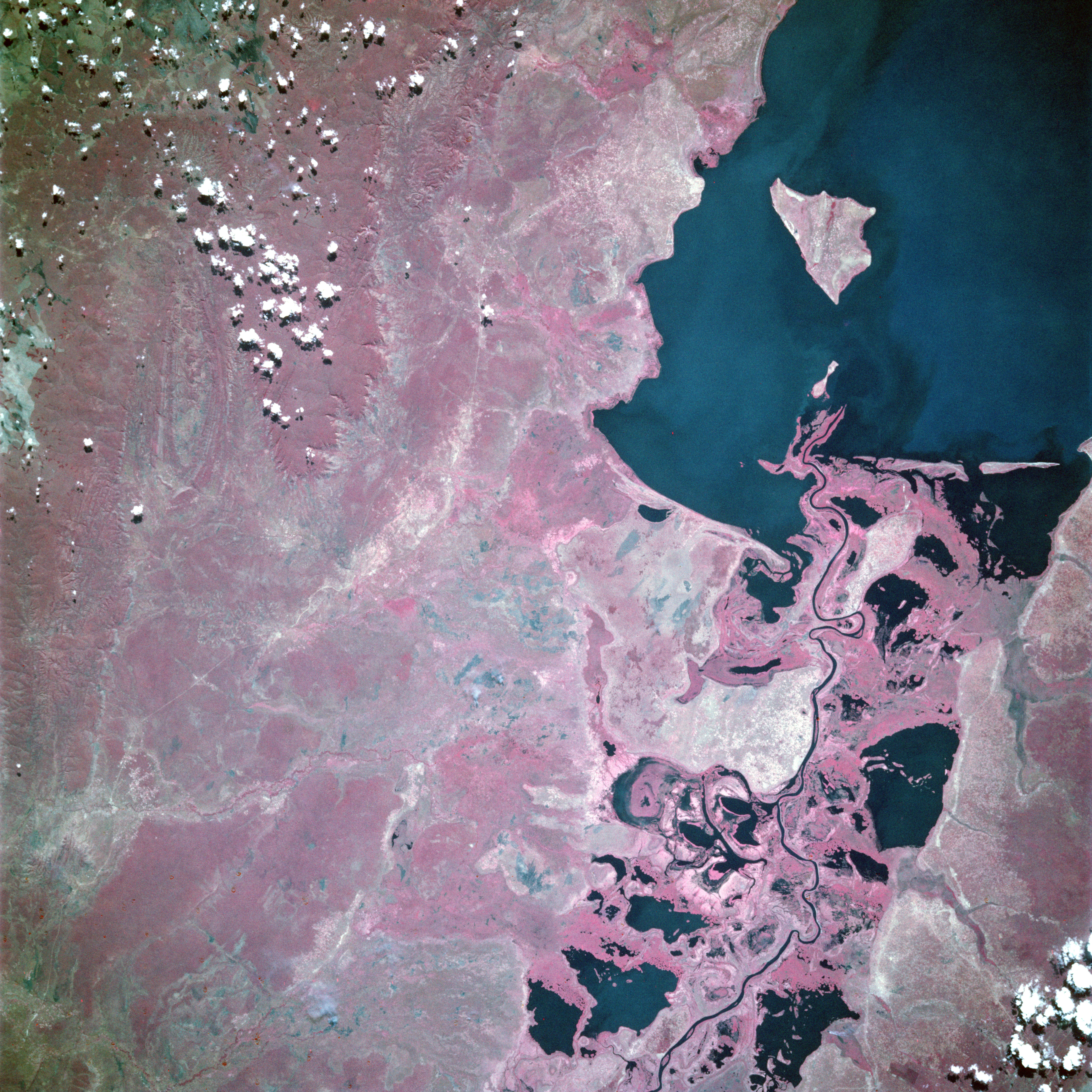
Descripción: Lake Mweru, Democratic Republic of the Congo and Zambia - June 1993 The southern end of Lake Mweru, a large freshwater lake with a maximum depth of at least 80 feet (25 meters), is visible in this near-vertical, color infrared photograph. The lake forms part of the border between Zaire to the west and Zambia to the east. The lake, noted for its large fisheries, is part of the Bangweulu wetland system and the Luapula River, which flows northward through the lake and is a headstream of the Zaire (Congo) River. The Luapula River's main channel, south of the lake, meanders through the swampy floodplain where many open bodies of water are identified as dark features within the heavily vegetated marshland. The roughly triangular lake island near the southern end of Lake Mweru belongs to Zambia. Visible west of the lake is the northern portion of the Kundelungu Mountains, a range of low mountains and escarpments, through which a roadway winds between some of the more elevated landforms. The reddish pink color on color infrared film designates green vegetation and indicates areas with dense foliage south and west of the lake.
Título: Lake mweru
Créditos: https://eol.jsc.nasa.gov/SearchPhotos/photo.pl?mission=STS057&roll=104&frame=63
Autor(a): NASA
Términos de Uso: Dominio Público
Licencia: Dominio Público
¿Se exige la atribución?: No
Usos del archivo
La siguiente página enlaza a este archivo:
