
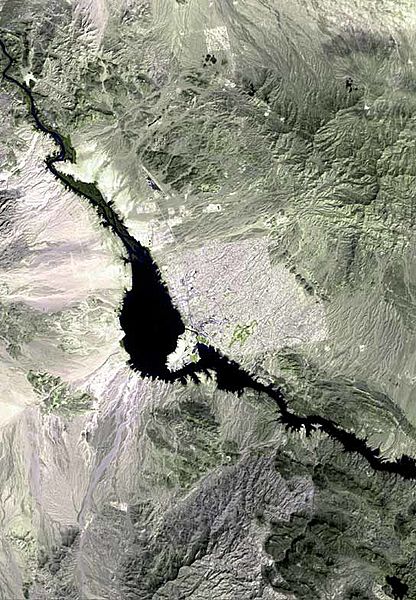
Archivo: Lake havasu city map

Tamaño de esta previsualización: 416 × 600 píxeles. Otras resoluciones: 166 × 240 píxeles | 544 × 784 píxeles.
Archivo original (544 × 784 píxeles; tamaño de archivo: 72 KB; tipo MIME: image/jpeg)
Description: The raw satellite imagery shown in these images was obtained from NASA and/or the US Geological Survey. Post-processing and production by www.terraprints.com; Note: The outfall of the w:Chemehuevi Wash out of Chemehuevi Valley is on the left bank (west) of w:Lake Havasu, at the widest section, just south of left-bank center.
Title: Lake havasu city map
Credit: www.terraprints.com
Author: http://www.terraprints.com
Usage Terms: Creative Commons Attribution 2.5
License: CC BY 2.5
License Link: https://creativecommons.org/licenses/by/2.5
Attribution Required?: Yes
Usos del archivo
La siguiente página enlaza a este archivo:

Todo el contenido de los artículos de la Enciclopedia Kiddle (incluidas las imágenes) se puede utilizar libremente para fines personales y educativos bajo la licencia Atribución-CompartirIgual a menos que se indique lo contrario.