
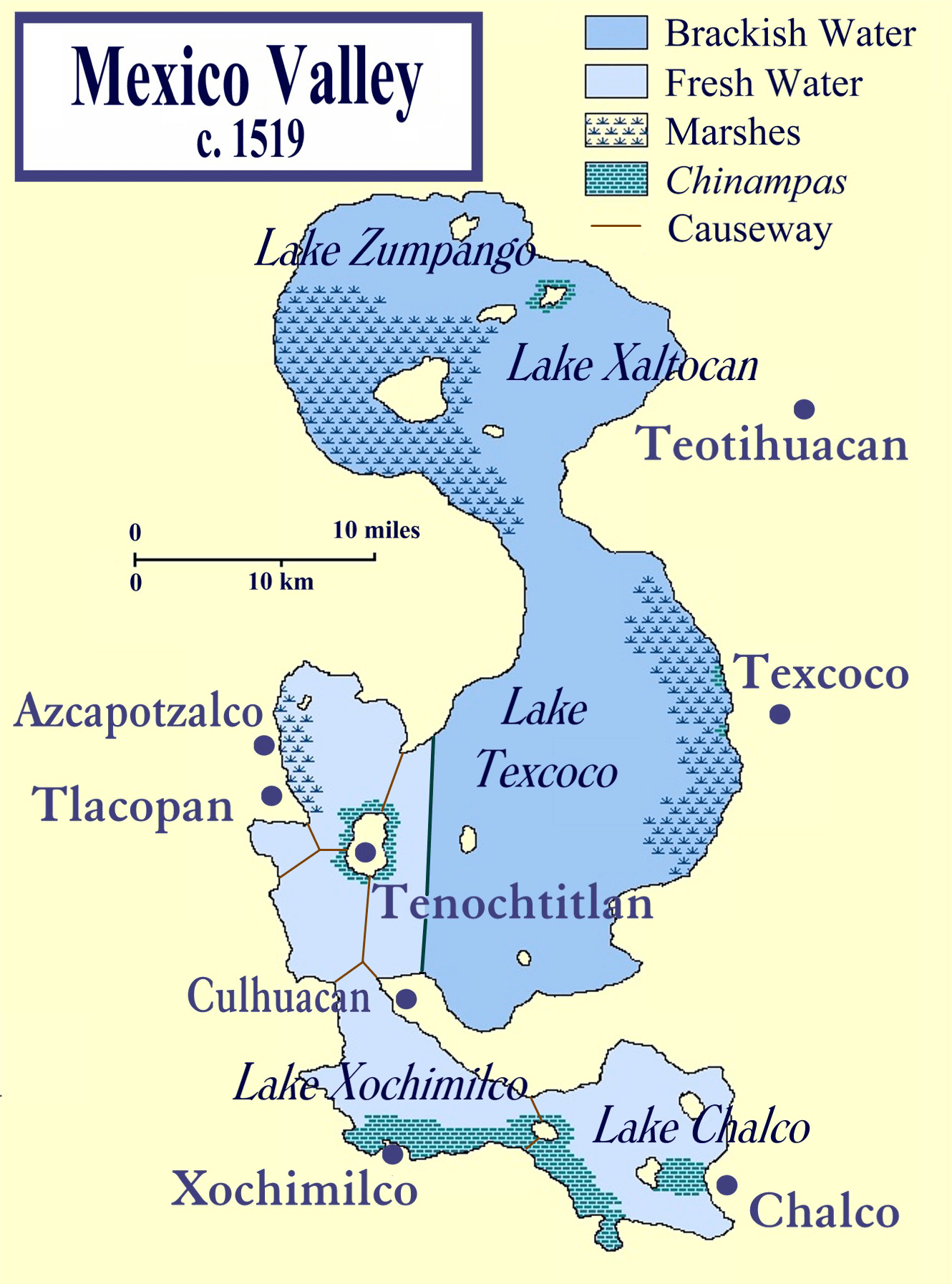
Archivo: Lake Texcoco c 1519
Tamaño de esta previsualización: 444 × 599 píxeles. Otras resoluciones: 178 × 240 píxeles | 1330 × 1794 píxeles.
Archivo original (1330 × 1794 píxeles; tamaño de archivo: 1,64 MB; tipo MIME: image/png)
Description: This is a map of the Valley of Mexico on the eve of the Spanish conquest of Mexico. It shows the major towns within the Valley, in particular, the island capital of the Aztecs, Tenochtitlan. The map also shows the five lakes that once existed within the Valley, highlighted to differentiate the brackish from the fresh waters. It was compiled from several sources, most prominently those listed below
Title: Lake Texcoco c 1519
Credit: Self-published work by Madman2001
Author: Madman2001
Usage Terms: Creative Commons Attribution-Share Alike 3.0
License: CC-BY-SA-3.0
License Link: http://creativecommons.org/licenses/by-sa/3.0/
Attribution Required?: Yes
Usos del archivo
Las siguientes páginas enlazan a este archivo:

Todo el contenido de los artículos de la Enciclopedia Kiddle (incluidas las imágenes) se puede utilizar libremente para fines personales y educativos bajo la licencia Atribución-CompartirIgual a menos que se indique lo contrario.