
Archivo: LIRR map

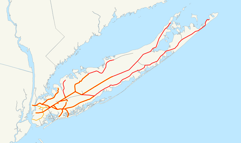
Description: This is a map of the rail network currently owned by the Long Island Rail Road. Orange lines are freight-only, and are operated by the New York and Atlantic Railway. Thin black lines have been abandoned. A yellow highlight indicates electrification. The following GIS data was used: NORTAD for boundaries 2006 National Transportation Atlas Database for U.S. rail lines A standard North American Lambert conformal conic projection was used.
Title: LIRR map
Credit: No machine-readable source provided. Own work assumed (based on copyright claims).
Author: No machine-readable author provided. NE2 assumed (based on copyright claims).
Usage Terms: Public domain
License: Public domain
Attribution Required?: No
Usos del archivo
La siguiente página enlaza a este archivo:
