
Archivo: Konbaung 1767 Map 2
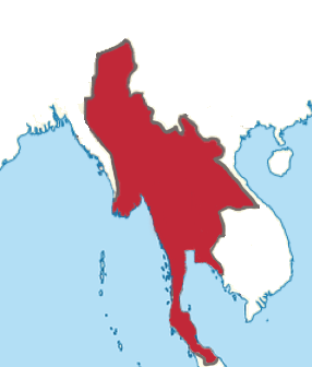
Descripción: Burmese areas of influence in April 1767. Manipur and Upper Burma's borders may be inaccurate. Small-scale guerrilla areas not shown.
Título: Konbaung 1767 Map 2
Créditos: Based off descriptions in: Wood, W.A.R. History of Siam. Myint, Soe Thuzar. Yodayar Naing Mawgun by Letwe Nawrahta: A Contemporary Myanmar Record, Long Lost, of How Ayutthaya Was Conquered. Journal of the Siam Society. https://thesiamsociety.org/wp-content/uploads/2011/04/JSS_099_0d_SoeThuzarMyint_YodayarNaingMawgun.pdf Baker, Chris. Phongpaichit, Pasuk. History of Ayutthaya: Siam in the Early Modern World. Wyatt, David K.. Siam and Laos, 1767-1827. Journal of the Siam Society. https://www.jstor.org/stable/20067439?read-now=1&seq=3#page_scan_tab_contents Kyaw Theat, Maung. Burma's relations with her eastern neighbours in the Konbaung period, 1752-1819. Myint-U, Thant. The River of Lost Footsteps. pg. 191.
Autor(a): Yourlocallordandsavior
Términos de Uso: Creative Commons Attribution-Share Alike 4.0
Licencia: CC BY-SA 4.0
Enlace de Licencia: https://creativecommons.org/licenses/by-sa/4.0
¿Se exige la atribución?: Sí
Usos del archivo
La siguiente página enlaza a este archivo:
