
Archivo: Kaart van de Colonie Demerary 1786
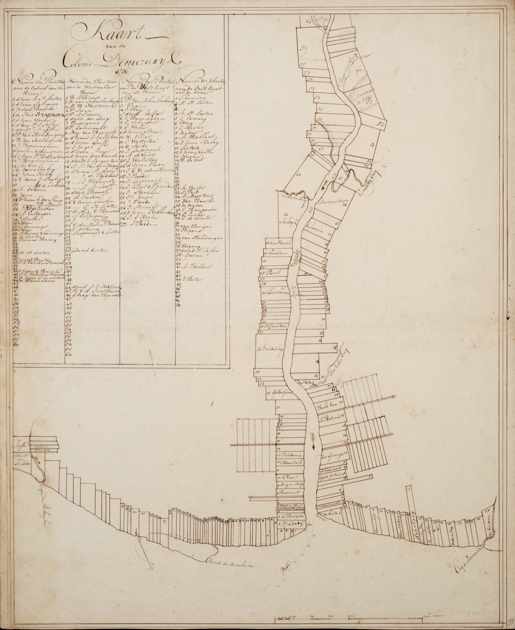
Descripción: Kaart van de Colonie Demerary 1786 Title Map of the Colonie Demerary Description The Demerary colony extended on both banks of the river and along the coast on both sides of the estuary. The plots point elongated inland. All are numbered, some have a name like 'Vrindschap', 'Belle Vue' and 'Goed Fortuin'. Four tables indicate the names of the owners, which correspond with the numbers of the plots. In defense, the mouth of the Demerary is flanked by a fortress and a redoubt. Type of original Card Keywords Plantations Maps (geography) Signature UBM: Card index: 102.18.03 Period subject 1786 Period manufacture 1786 Location subject Guyana Demerara Dimensions 59 x 47.5 cm Scale approx. 1: 110,000
Título: Kaart van de Colonie Demerary 1786
Créditos: http://dpc.uba.uva.nl/cgi/i/image/image-idx?view=entry;subview=detail;entryid=x-151;viewid=SURI01_KAARTENZL-102-18-03.SID;sid=d7bb0bb5e760ea4f715b0e6bec51b412;c=surinamica;cc=surinamica;corig=surinamica;lasttype=boolean;lastview=thumbnail;np=next
Autor(a): DesconocidoUnknown author
Términos de Uso: Dominio Público
Licencia: Dominio Público
¿Se exige la atribución?: No
Usos del archivo
La siguiente página enlaza a este archivo:
