
Archivo: Japan-Archipelago-Outlined-Islands-Map
Tamaño de esta previsualización: 734 × 600 píxeles. Otras resoluciones: 294 × 240 píxeles | 2012 × 1644 píxeles.
Archivo original (2012 × 1644 píxeles; tamaño de archivo: 3,2 MB; tipo MIME: image/png)
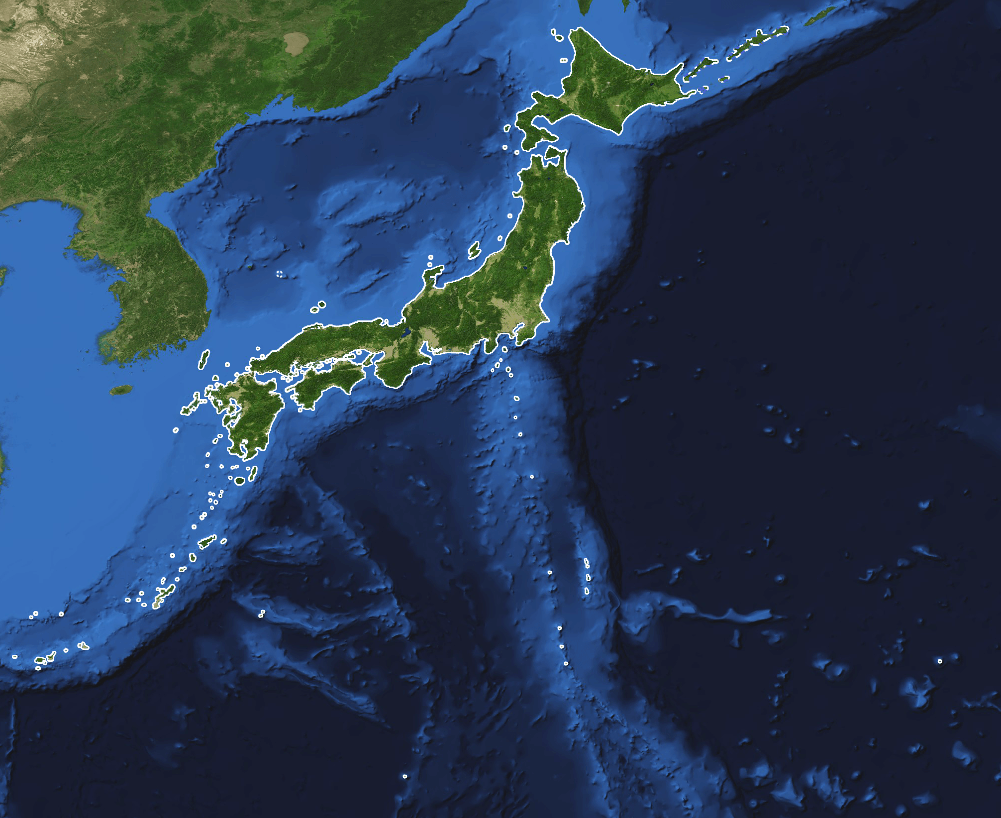
Description: This is a topography and bathymetry map of the Japanese archipelago with outlined islands. It shows the land and the seabed of Japan. All significant Japanese owned and controlled islands are outlined with a solid line such as Minami-Tori-Shima, Okinotorishima, Yonaguni and the Senkaku islands. The northern territories (kuril islands) and Takeshima have a dashed line.
Title: Japan-Archipelago-Outlined-Islands-Map
Credit: Blue Marble Next Generation W/ Topography and Bathymetry (July 1 - 31, 2004) https://visibleearth.nasa.gov/view.php?id=73751
Author: Credit: Reto Stöckli, NASA Earth Observatory
Usage Terms: Public domain
License: Public domain
Attribution Required?: No
Usos del archivo
La siguiente página enlaza a este archivo:

Todo el contenido de los artículos de la Enciclopedia Kiddle (incluidas las imágenes) se puede utilizar libremente para fines personales y educativos bajo la licencia Atribución-CompartirIgual a menos que se indique lo contrario.