
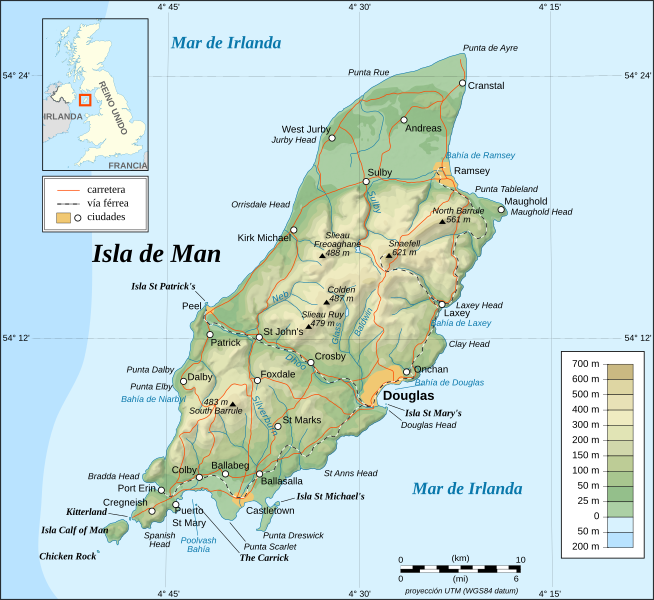
Archivo: Isle of Man topographic map-es

Descripción: Mapa topográfico en español de la Isla de Man. Nota : El relieve sombreado es una imagen bitmap integrada en el SVG.
Título: Isle of Man topographic map-es
Créditos: Own work ; Topographic map: NASA Shuttle Radar Topography Mission (SRTM3 v.2) (public domain) edited with 3DEM from Visualization Software LLC and vectorized with Inkscape; Other references used for additional data: Image:IsleofManmap.png modified by en-user:Kelisi under GFDL; Demis add-on for World Wind (see the approval e-mail and Demis forum); NASA World Wind; UK Genealogy map; Microsoft Encarta atlas (1999 edition); Locator map: Image:Gb4dot_merged_mapcolors.svg created by Wereon and Ilmari Karonen in public domain.
Autor(a): Eric Gaba (Sting), translated by Koszmonaut
Términos de Uso: Creative Commons Attribution-Share Alike 4.0
Licencia: CC BY-SA 4.0
Enlace de Licencia: https://creativecommons.org/licenses/by-sa/4.0
¿Se exige la atribución?: Sí
Usos del archivo
La siguiente página enlaza a este archivo:
