
Archivo: IrishSeaReliefMap
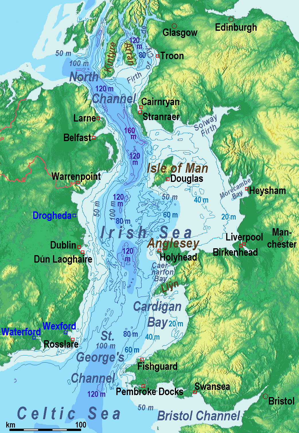
Descripción: A map of the en:Irish Sea. Major ports shown with red marks. freight-only ports in blue. The old map with this lemma had significant mistakes of the bathymetry. Therefore on 2014-05-11, it was exchanged for a completely new map. Now the bathymetric content is an own work based on various informations. The countures of depth are drawn according to the UK source, the areal colours are derived from the Irish one. The land is from Maps for Free.
Título: IrishSeaReliefMap
Créditos: old map: http://www.vindaloo.uklinux.net/jjg/code/tmutils.html-> new map: Maps for Free and Trabajo propio
Autor(a): old one Users SFC9394, Seabhcan on en.wikipedia, new one Ulamm (talk) 01:37, 11 May 2014 (UTC)
Permiso: old map: from http://www.vindaloo.uklinux.net/jjg/code/tmutils.html. Released to public domain by creator.
Términos de Uso: Creative Commons Attribution-Share Alike 3.0
Licencia: CC BY-SA 3.0
Enlace de Licencia: https://creativecommons.org/licenses/by-sa/3.0
¿Se exige la atribución?: Sí
Usos del archivo
Las siguientes páginas enlazan a este archivo:
