
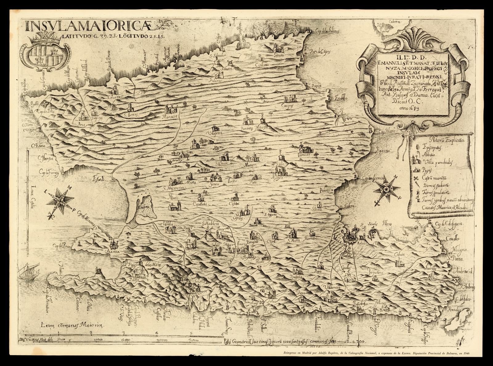
Archivo: Insula Maioricae Vicentius Mut 1683
Tamaño de esta previsualización: 800 × 594 píxeles. Otras resoluciones: 320 × 237 píxeles | 7388 × 5481 píxeles.
Archivo original (7388 × 5481 píxeles; tamaño de archivo: 16,82 MB; tipo MIME: image/jpeg)
Description: Map of the island of Majorca delineated by Vicente Mut and dated 1683. Place names in Catalan and legends in Latin. Reprinted in Madrid in 1946 by Adolfo Rupérez, of the Calcografia Nacional, at the expense of the Diputación de Baleares. Actual dimensions: 42 x 58 cm
Title: Insula Maioricae Vicentius Mut 1683
Credit: ICGC
Author: Don Vincentius Mut deli.
Permission: Creative Commons Public Domain mark 1.0
Usage Terms: Public domain
License: Public domain
Attribution Required?: No
Usos del archivo
No hay páginas que enlacen a esta imagen.

Todo el contenido de los artículos de la Enciclopedia Kiddle (incluidas las imágenes) se puede utilizar libremente para fines personales y educativos bajo la licencia Atribución-CompartirIgual a menos que se indique lo contrario.