
Archivo: Indus.A2002274.0610.1km
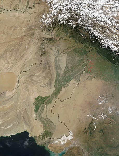
Description: en:Satellite image of the en:Indus River basin. Red dots indicate fires. International boundaries are superimposed; the boundary through en:Jammu and Kashmir reflects the en:Line of Control. Agricultural burning is occurring in Northwest India (usually at right) and Pakistan (at left )near the Indus River in October 2002. The Moderate Resolution Imaging Spectroradiometer on the Aqua satellite detected numerous fires (red dots) burning just east of India’s border with Pakistan (upper left quadrant). The haze in the area is probably not solely due to the fires, however; some of it is likely urban air pollution from several large cities in the region. In the upper right quadrant, the foothills of the Himalayas are deep green, and the peaks are dusted with snow and capped by clouds.
Title: Indus.A2002274.0610.1km
Credit: visibleearth.nasa.gov/view.php?id=62558
Author: Credit: Jacques Descloitres, MODIS Rapid Response Team, NASA/GSFC
Usage Terms: Public domain
License: Public domain
Attribution Required?: No
Usos del archivo
Las siguientes páginas enlazan a este archivo:
